Rich vs. Poor: What It Looks Like from Above
Aerial photographs by drone photographer Jonny Miller vividly demonstrate the stark gap between rich and poor in cities across South Africa, Mexico, and India. 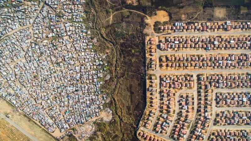
These photographs are part of Jonny Miller's "Unequal Scenes" project, which he began in April 2016 to visually demonstrate inequality between people. 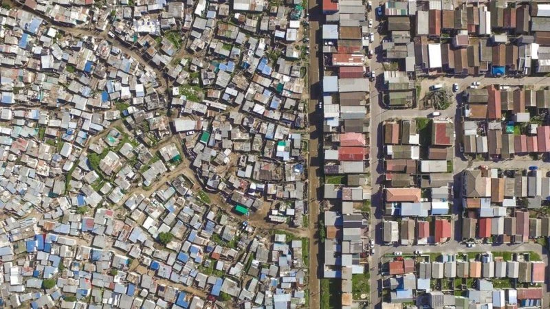
Vukuzenzele, Cape Town
"From the moment you land in Cape Town, you're surrounded by shacks. Literally, shacks surround the airport, and you have to drive past them for about 10 minutes until you reach the wealthier suburbs where the privileged live (myself included)," says the South African photographer. 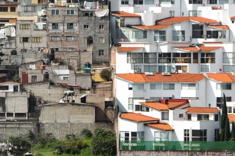

Как садят рис
Смотреть видеоSanta Fe, Mexico City
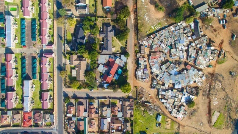
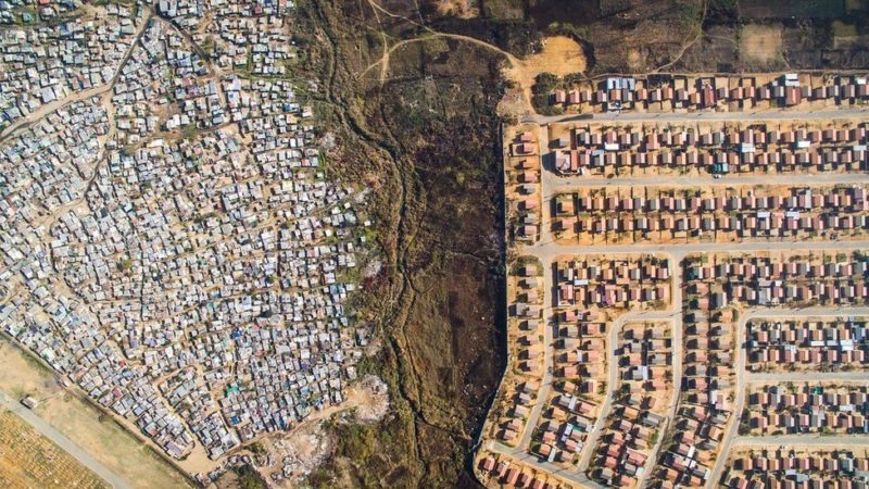
Casey Park, Johannesburg
Miller says: "This is commonplace in Cape Town, South Africa, and many parts of the world, but it's something I disagree with. To paraphrase Barack Obama, I believe addressing inequality is the defining challenge of this generation."
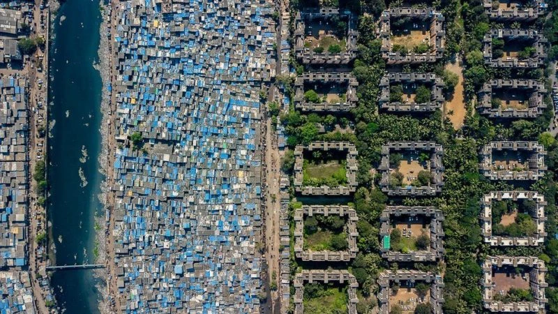
Mumbai (Bombay before 1995)
The top corner, known as the "Nadir view," shows the boundaries made up of fences or roads separating rich and poor. On one side are slums, and opposite are wealthy homes and mansions.
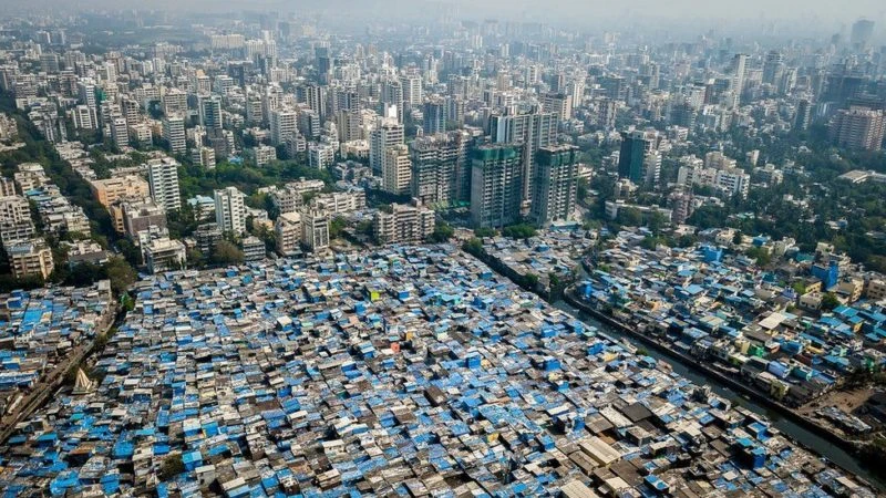
Mumbai
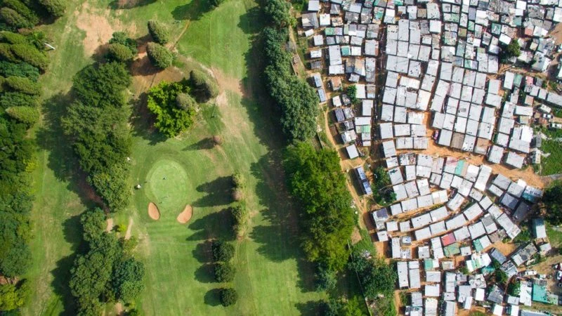
Golf Course, Durban, South Africa
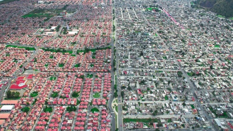
Ixtapaluca, Mexico City
Tombisa, Johannesburg, South Africa
Finding the best locations for drone photography requires a fair amount of preparation for Miller.
"I determine where to photograph using a variety of tools—a combination of census data, maps, news reports, and live conversations with people."
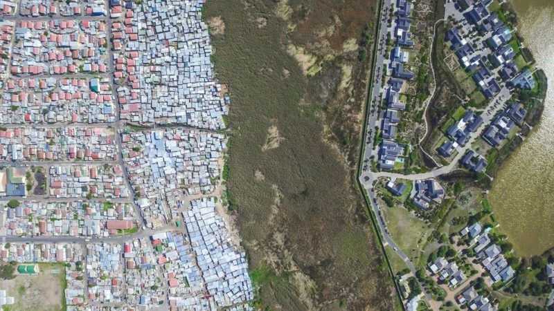
Lake Michelle, Masiphumelele, Cape Town
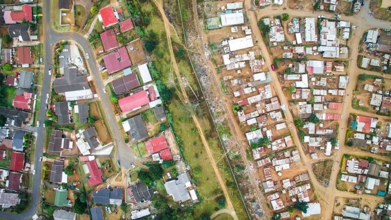
Pietermaritzburg, South Africa
"Once I identify the areas I want to photograph, I visualize them on Google Earth and try to formulate a flight plan, including taking into account air traffic regulations, flight safety, personal safety, drone battery life, range, weather, angle, time of day, and many other factors."
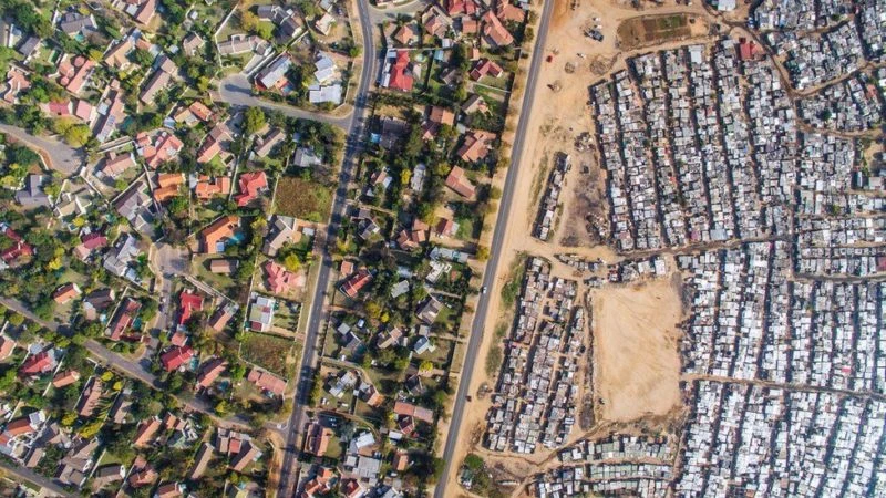
Johannesburg, South Africa

Download
Archive size 1.51 Mb, downloaded 23 times