Earth as a work of art
The "Earth as Art" photo collection, presented by the U.S. Geological Survey and NASA, includes stunning photographs taken by Landsat satellites that showcase the geographic diversity of our planet. 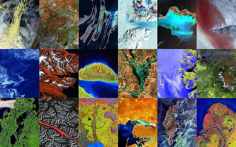
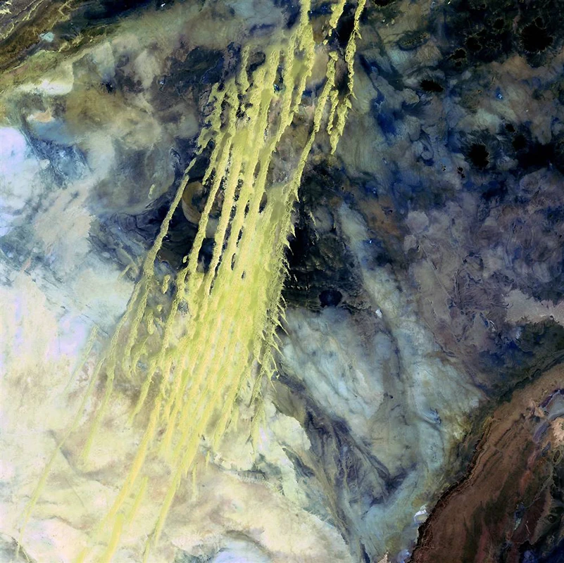
This image looks like pale yellow streaks of paint. They are actually wind-blown sand patterns from Erg Igidi, a region of constantly shifting sand dunes in northwest Africa. (USGS and NASA) 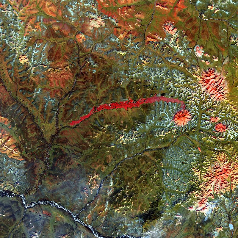

Как садят рис
Смотреть видеоThe raised red stripe in the center of this image represents the remains of a lava flow and landslide. Their source is the now-dormant Anyui Volcano. This remote and virtually inaccessible region is a concentration of volcanoes, gently sloping valleys, and pristine rivers and streams fed by snowmelt. (USGS and NASA)
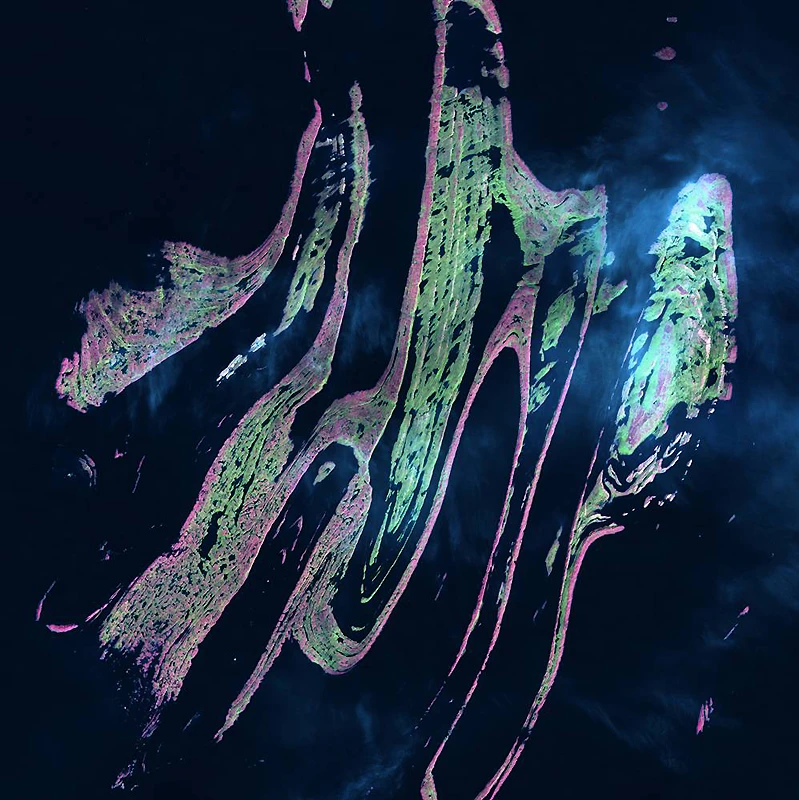
Like broad brushstrokes of pink and green paint, the Belcher Islands cut across the deep blue of Canada's Hudson Bay. The islands' few inhabitants are concentrated in the small town of Sanikilihuaq, near the tip of the middle island. Despite the green hues in this color-coded image, these islands are too cold to support any significant vegetation. (USGS and NASA)
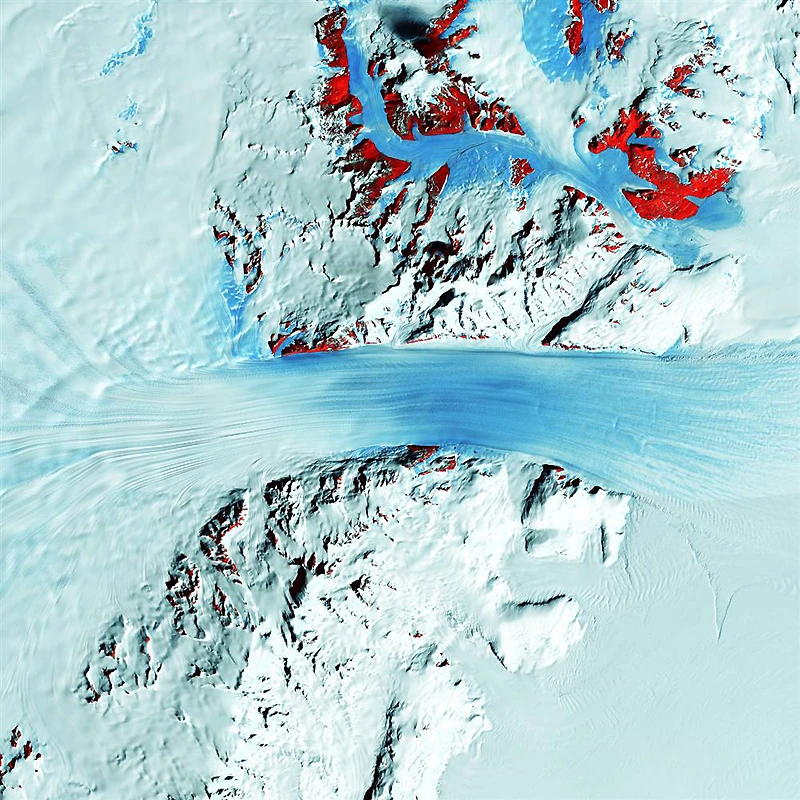
Like a veritable river of ice, the fast-moving Byrd Glacier cuts through the Transantarctic Mountains at a rate of 0.8 km per year. The 180 km-long glacier moves from the polar plateau (left) toward the Ross Ice Shelf (right). Long, sweeping lines are intersected in places by shorter lines representing deep crevasses in the ice. In this color-coded image, the red areas represent exposed rock. (USGS and NASA)
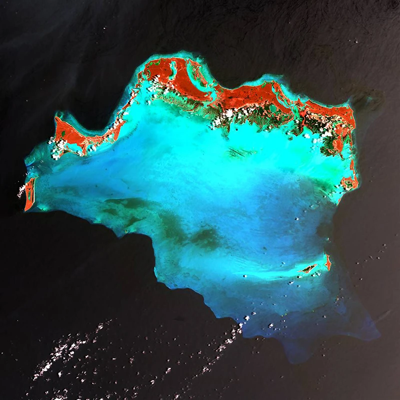
The Caicos Islands in the northern Caribbean are a popular tourist destination known for their beautiful beaches, clear waters, scuba diving, and luxury hotels. The islands are located along the northern perimeter of a submerged silt platform formed by sand, seagrass, and coral reefs, covering an area of 6,140 square kilometers. In this color-coded image, the platform is shown in turquoise and the vegetation is shown in red. (USGS and NASA)
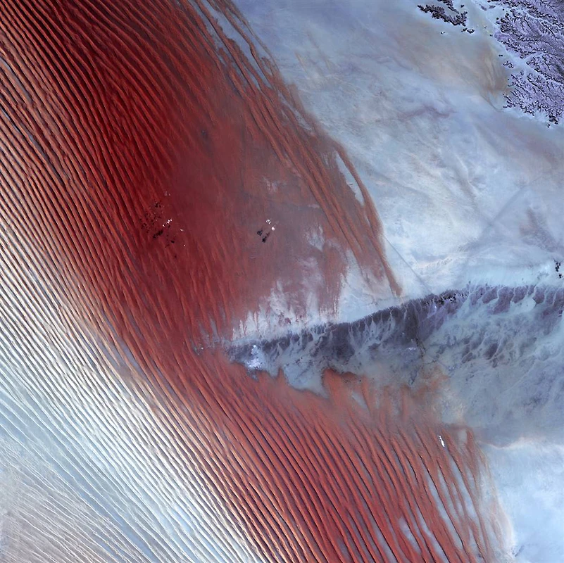
Pinpoint clouds cast shadows on the Rub' al-Khali, near the border between Saudi Arabia and Yemen. Wind-blown sand lines are characteristic of sand deserts or sand seas, and the Rub' al-Khali is the largest such desert in the world. A high ridge is high enough to disrupt the movement of the lines. At the center of this movement lies the Saudi Arabian city of Sharurah. (USGS and NASA)
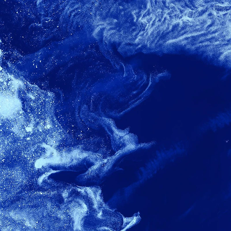
Like distant galaxies amid clouds of interstellar dust, chunks of drift ice float gracefully through the icy waters of Foxe Bay near Baffin Island in the Canadian Arctic. Sea ice often forms as a dirty film of ice crystals on the ocean surface. As temperatures drop, the ice compacts and coalesces into large chunks of solid ice. (USGS and NASA)
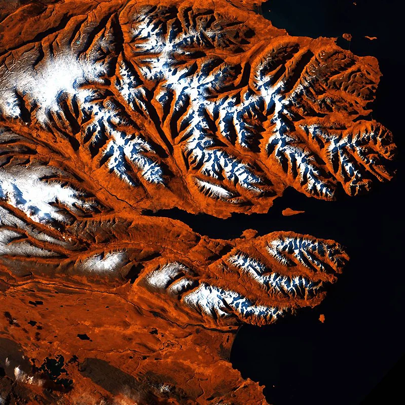
This strip of Iceland's northern coastline resembles a tiger's head, with orange, black, and white stripes. The tiger's "mouth" is the deep fjord of Eyjafjörður, jutting into the land between gently rolling mountains. The name translates as "island fjord," derived from the island of Hrisey near the "mouth." The ice-free port city of Akureyri lies near the narrow end of the fjord and is Iceland's second most populous city after the capital, Reykjavik. (USGS and NASA)
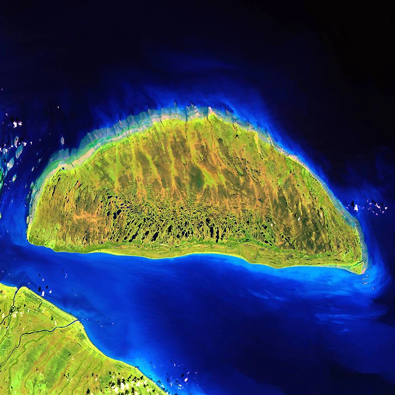
During the last ice age, Akimiski Island in Canada's James Bay lay beneath vast glaciers, pressed down with incredible force. As the climate changed and the ice melted, Akimiski Island began to move backward. This slow but steady increase is recorded along natural edges, where the shoreline appears to be etched with raised rings—the result of land uplift and wave action at previous sea levels. (USGS and NASA)
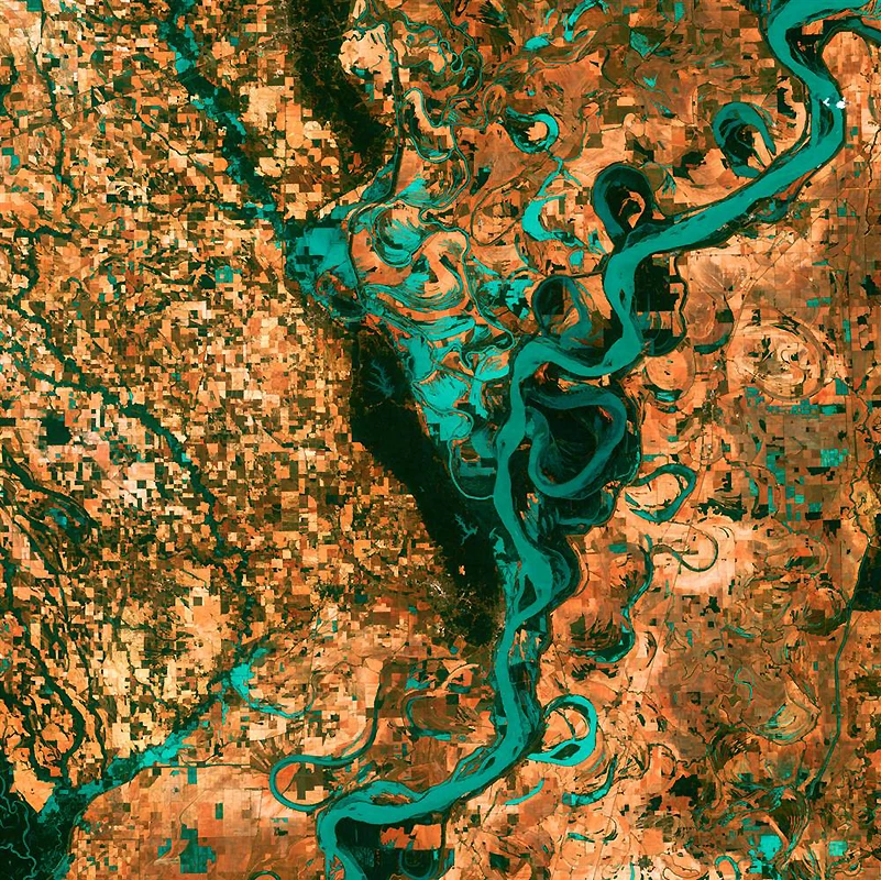
Small rectangles of villages, fields, and pastures surround the graceful swirls and curls of the Mississippi River. Endless floodplain lakes and bypass roads line the river south of Memphis, Tennessee, on the border between Arkansas and Mississippi. The "Mighty Mississippi" is the largest river system in North America. (USGS and NASA)
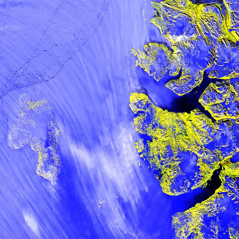
In this Landsat image, a haze of snow nearly obscures Meighen Island (left) off the northern coast of Canada. Across the Sverdrup Channel lies the larger Alex Heiberg Island, where glaciers (blue) crowd among mountain peaks (yellow) and cut deep into fjords. No evidence of human life has ever been found on Meighen Island. (USGS and NASA)
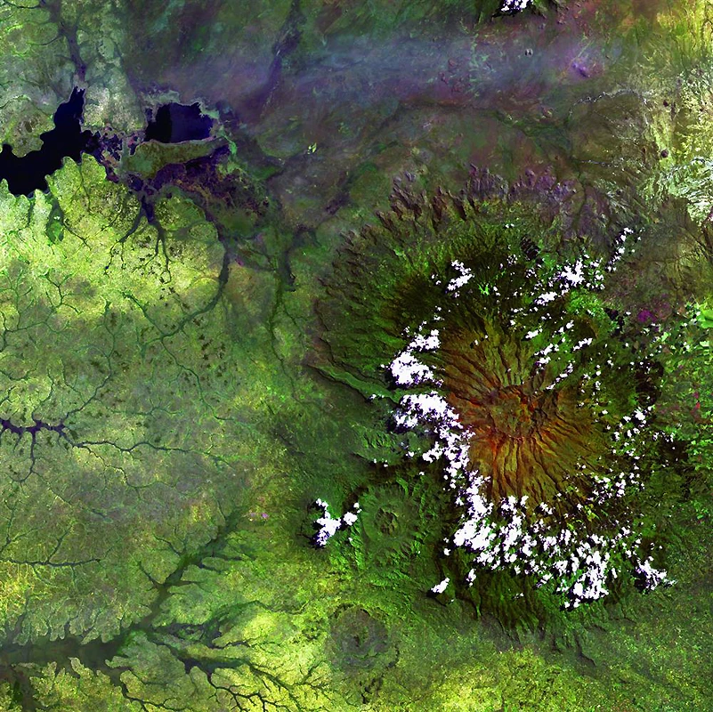
Clouds encircle the high rim of Africa's Mount Elgon, a large, long-extinct volcano on the border between Uganda and Kenya. The solitary volcano has one of the largest continuous calderas. The caldera is approximately 6.5 kilometers in diameter and was formed after an eruption when an empty magma basin collapsed under the weight of the volcanic rock above. (USGS and NASA)
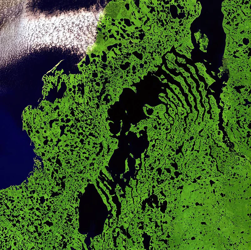
Skeletal formations stretch like bony fingers across Liverpool Bay, along the northern edge of Canada's Northwest Territories. Only a few villages are scattered across this remote and inhospitable region of Arctic tundra bordering the Beaufort Sea. In summer, this relatively flat landscape is dotted with shallow lakes. (USGS and NASA)
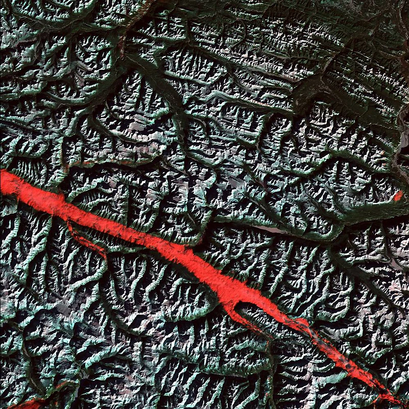
What appears to be a streak of deep red paint is actually a remarkable interplay of light and clouds in the Canadian Rockies. At an angle from the mountains lies a basin, a valley that stretches from Montana to the southern Yukon Territory. Low clouds partially fill a basin near the border between the Canadian provinces of Alberta and British Columbia. The reflective nature of the clouds, combined with the rising sun, creates this stunning effect. (USGS and NASA)
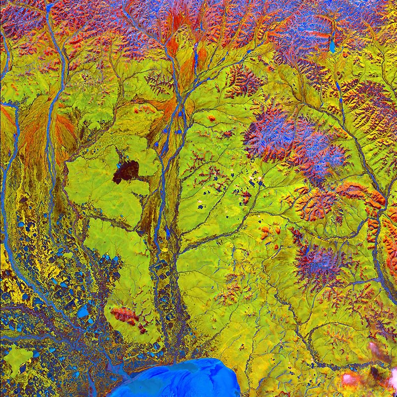
Bright colors and strange shapes come together in this image, which resembles a scene from a fantasy book. This labyrinth of exotic features is represented by the bright blue semicircle at the bottom of the image. Two major rivers, the Chaun and Palyavaam, flow into this bay, which in turn empties into the Arctic Ocean. Patchwork lakes and swamps, created by sediments left by retreating glaciers, can be found throughout the area. (USGS and NASA)
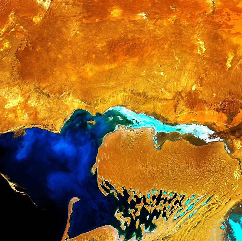
At first glance, it might look like some kind of terrifying ogre with something sticky in its mouth. In fact, it's the Darja Peninsula in western Turkmenistan, which lies amid the shallow coastal waters of the Caspian Sea. Strong winds create enormous sand dunes near the water, some of which are partially submerged. Further inland, these dunes transform into low sandy plains. (USGS and NASA)
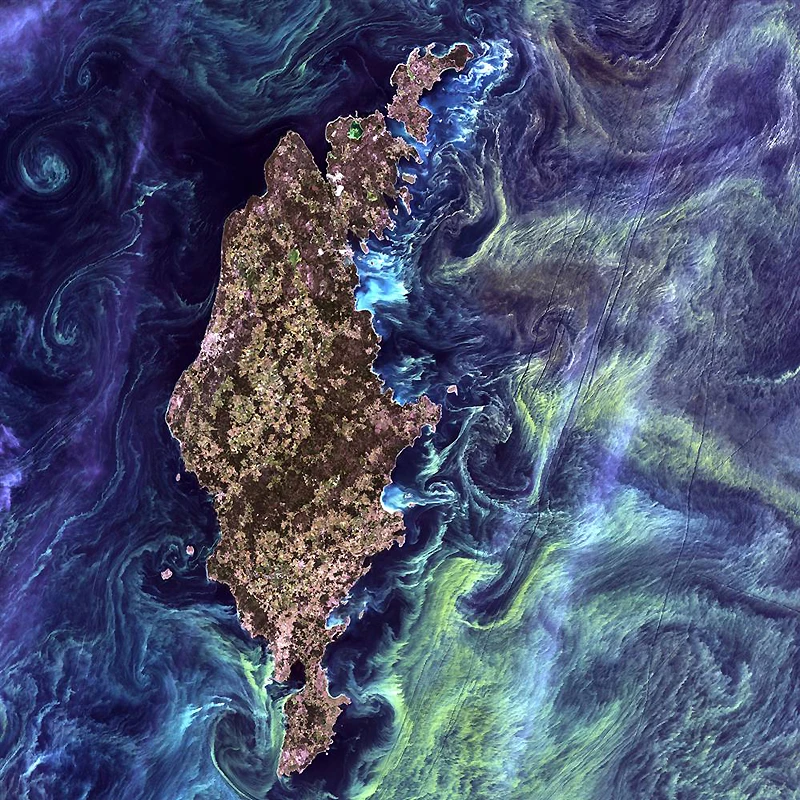
A photo resembling Van Gogh's "Starry Night" depicts the convergence of greenish swirls of phytoplankton in the dark waters around the Swedish island of Gotland in the Baltic Sea. Phytoplankton are microscopic marine algae that form the first link in virtually every marine food chain. Entire generations of phytoplankton grow when deep currents bring nutrients to the sunlit surface of the water, fueling the growth and reproduction of these tiny organisms. (USGS and NASA)
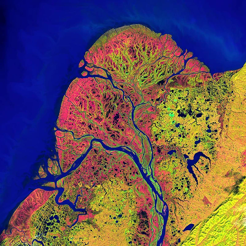
Starting in northern British Columbia and flowing through the Yukon Territory, the Yukon River crosses Alaska before emptying into the Bering Sea. Endless lakes, sloughs, and ponds dot this Yukon River Delta. The meandering, branching channels resemble blood vessels wrapped around an organ. It is one of the largest river deltas in the world and is now part of the protected Yukon National Wildlife Refuge. (USGS and NASA)

Download
Archive size 13.7 Mb, downloaded 25 times