The 20 most beautiful satellite images from the Google Earth collection
Google Earth has added over 1,000 new aerial photographs taken from space to its Earth View gallery. This is the largest update yet to the service's online gallery, which includes over 2,500 photographs taken on every continent. These stunning images are optimized for modern high-resolution screens, boasting vibrant colors, crisp images, and resolutions up to 4K. 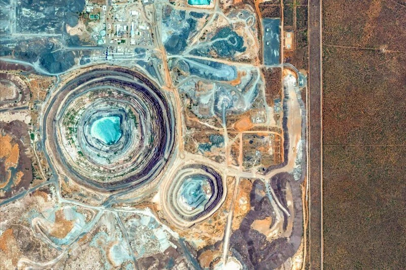
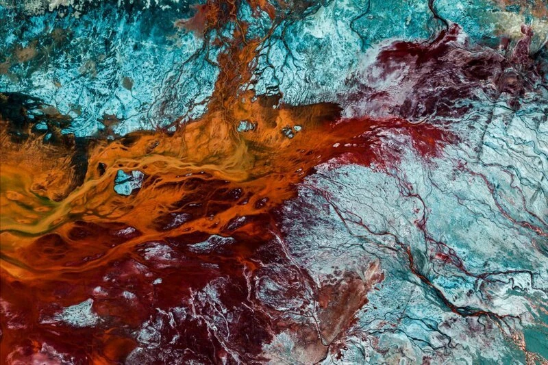
Volcanic activity zone in Susques, northern Argentina. 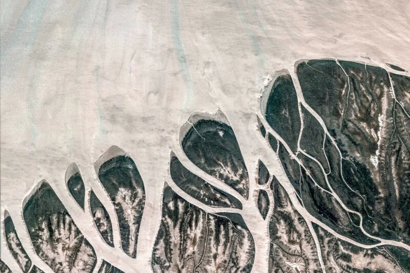

Как садят рис
Смотреть видеоRiver mouths in northern Madagascar.
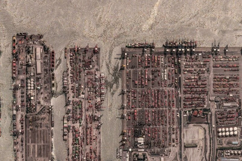
Located in Jakarta, Tanjung Priok is Indonesia's busiest port.
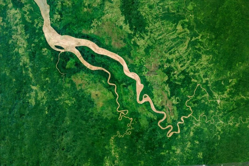
The sparsely populated Darien Province in eastern Panama.
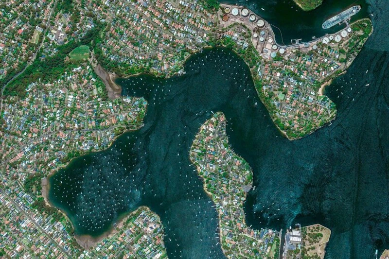
Villas in the prestigious Woolwich area, Sydney's wealthiest suburb.
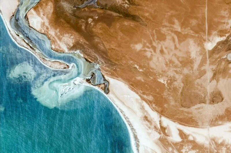
Daqlet Nouadhibou is a harbor on the Atlantic coast of Mauritania.
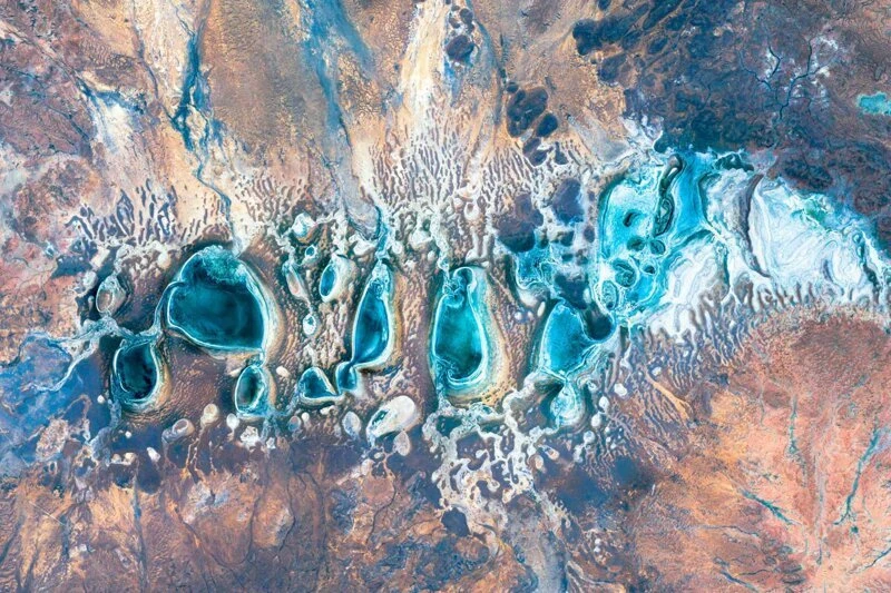
Coumarin Salt Flats, Western Australia.
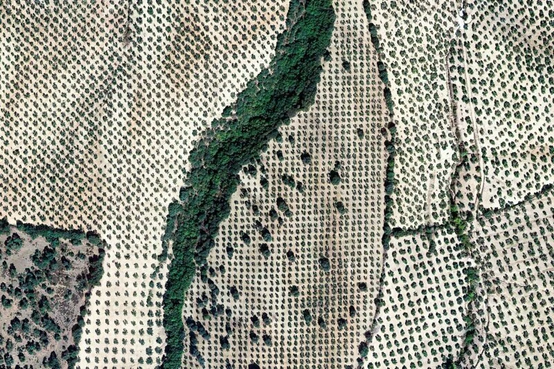
Olive groves in Setenil de las Bodegas, a town in southern Spain.
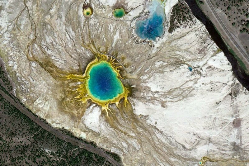
Grand Prismatic Spring in Yellowstone National Park, USA.
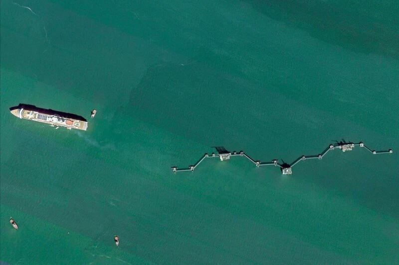
A cruise ship departs from the port of Edinburgh.
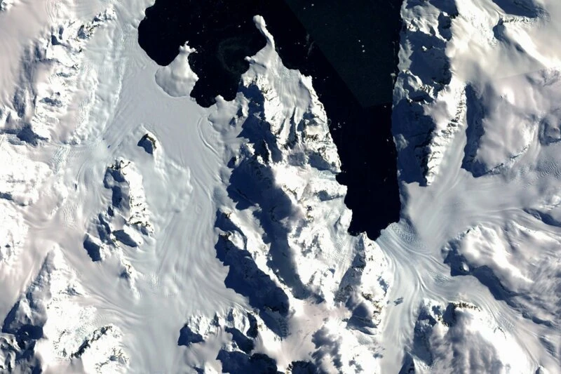
Arrowsmith Peninsula is the northernmost part of Antarctica.
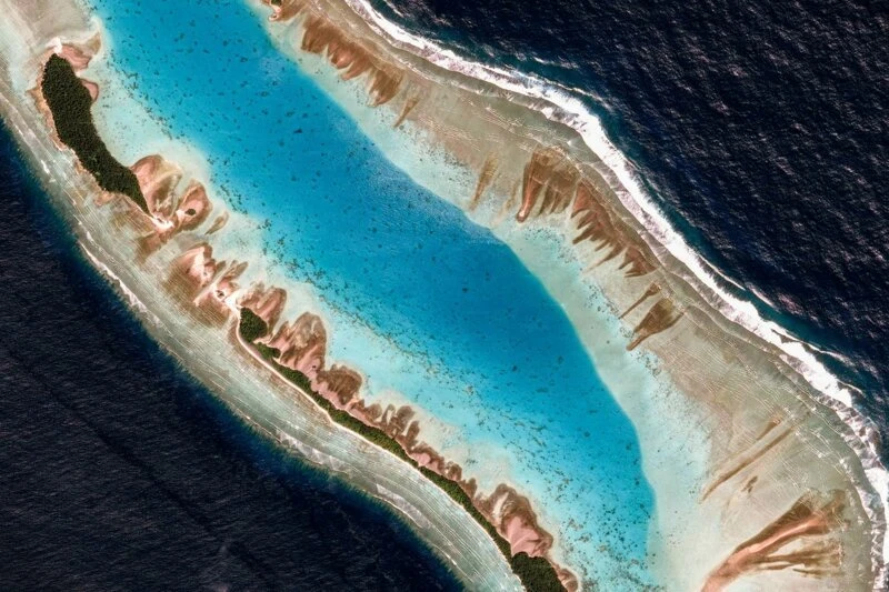
The coast of Mili Atoll, Marshall Islands. Coral reefs in the lagoon.
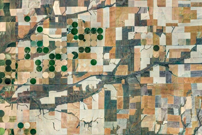
The crop circles in Ritzville, Washington, are the same ones that ufologists believe are traces of alien spacecraft landings.
The Letlhakane Diamond Mine is 200 kilometers west of Francistown, Botswana.
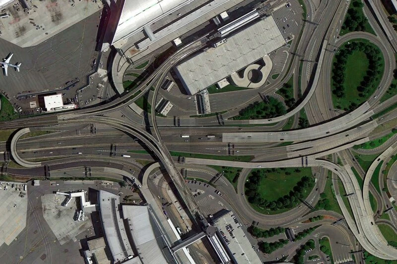
Approach roads near Kennedy Airport, New York.
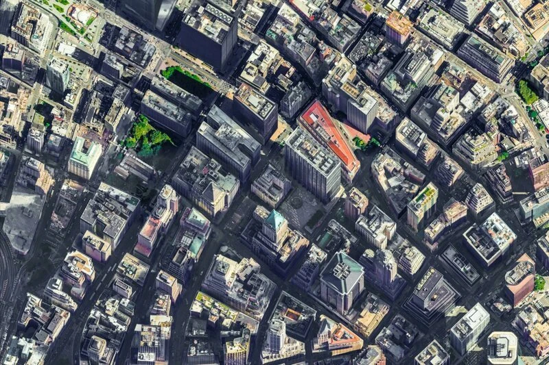
A bird's eye view of Manhattan. The building with the red roof is the Federal Reserve Bank.
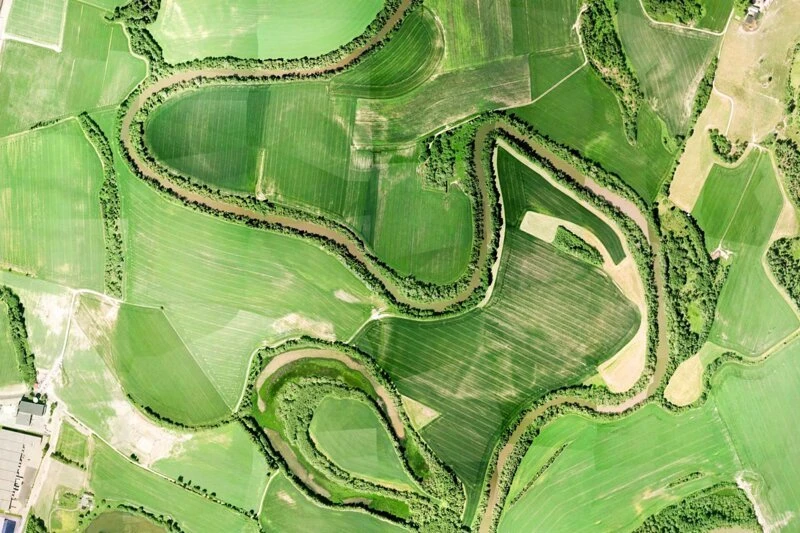
The Leira River near Lillestrom, Norway. It's less than 20 kilometers from here to the capital, Oslo.
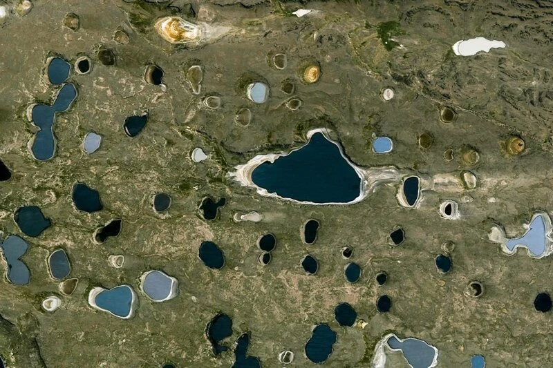
The small lakes between Lake Quiroga and Lake Strobel in Argentina's Santa Couz Province are a favorite spot for fishermen, despite the area being considered dry, cold, and windy.
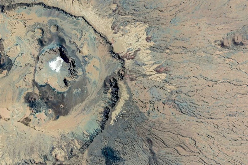
The Emi Koussi Crater is the highest mountain in Chad.
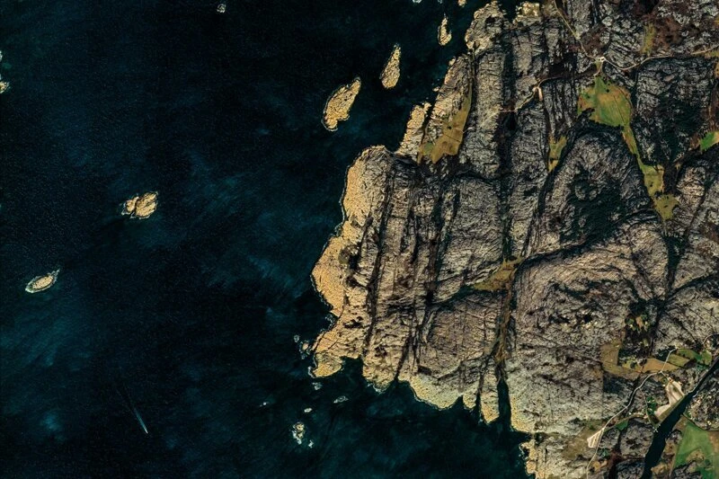
The rocky coastline of the Swedish province of Vastara Gotland.

Download
Archive size 2.52 Mb, downloaded 38 times