Collection of maps from National Geographic. Part 2 (21 photos)
Разрешение картинок от 3508x3777px до 4961x3464px
Contents of the second part:
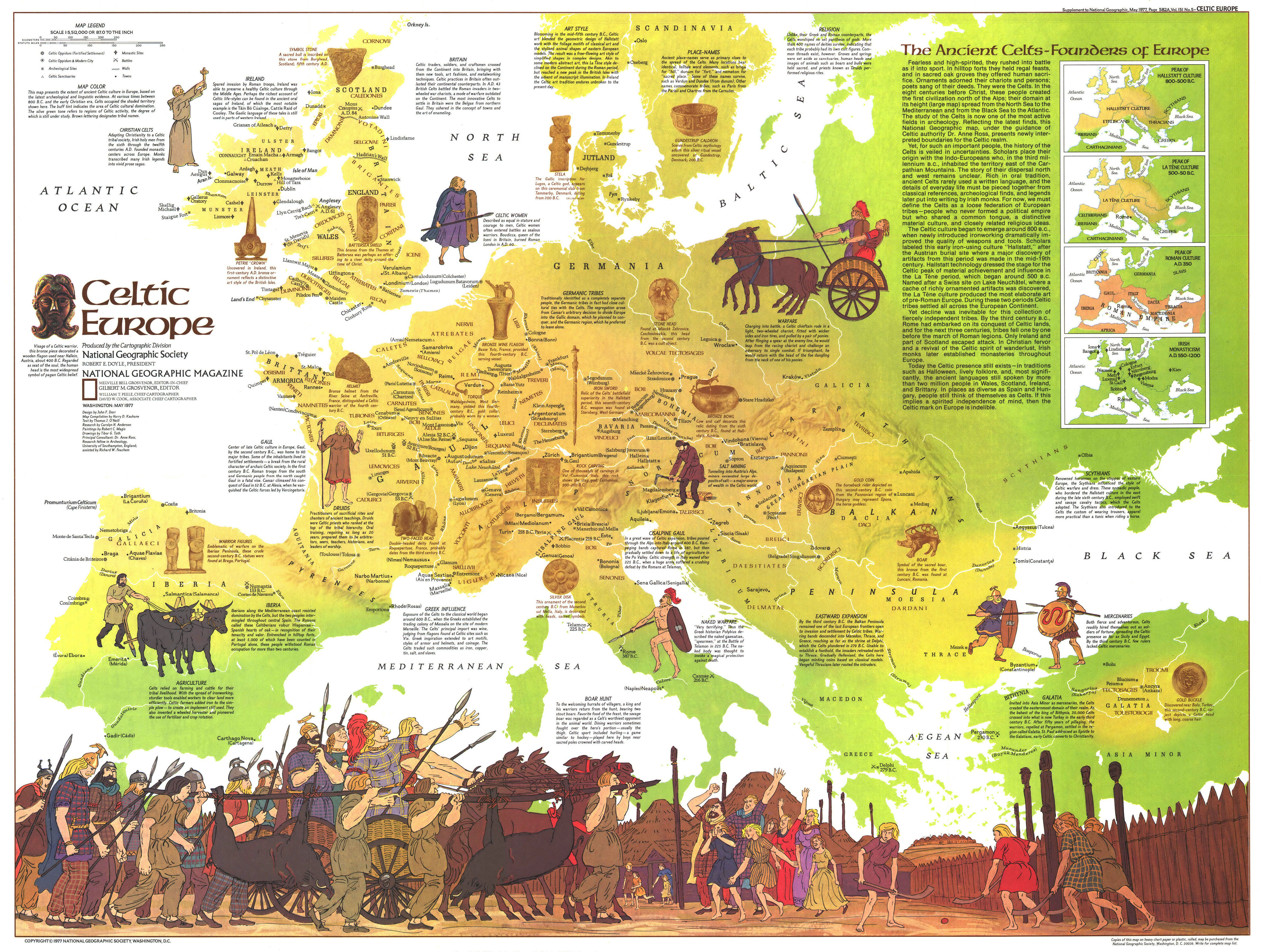
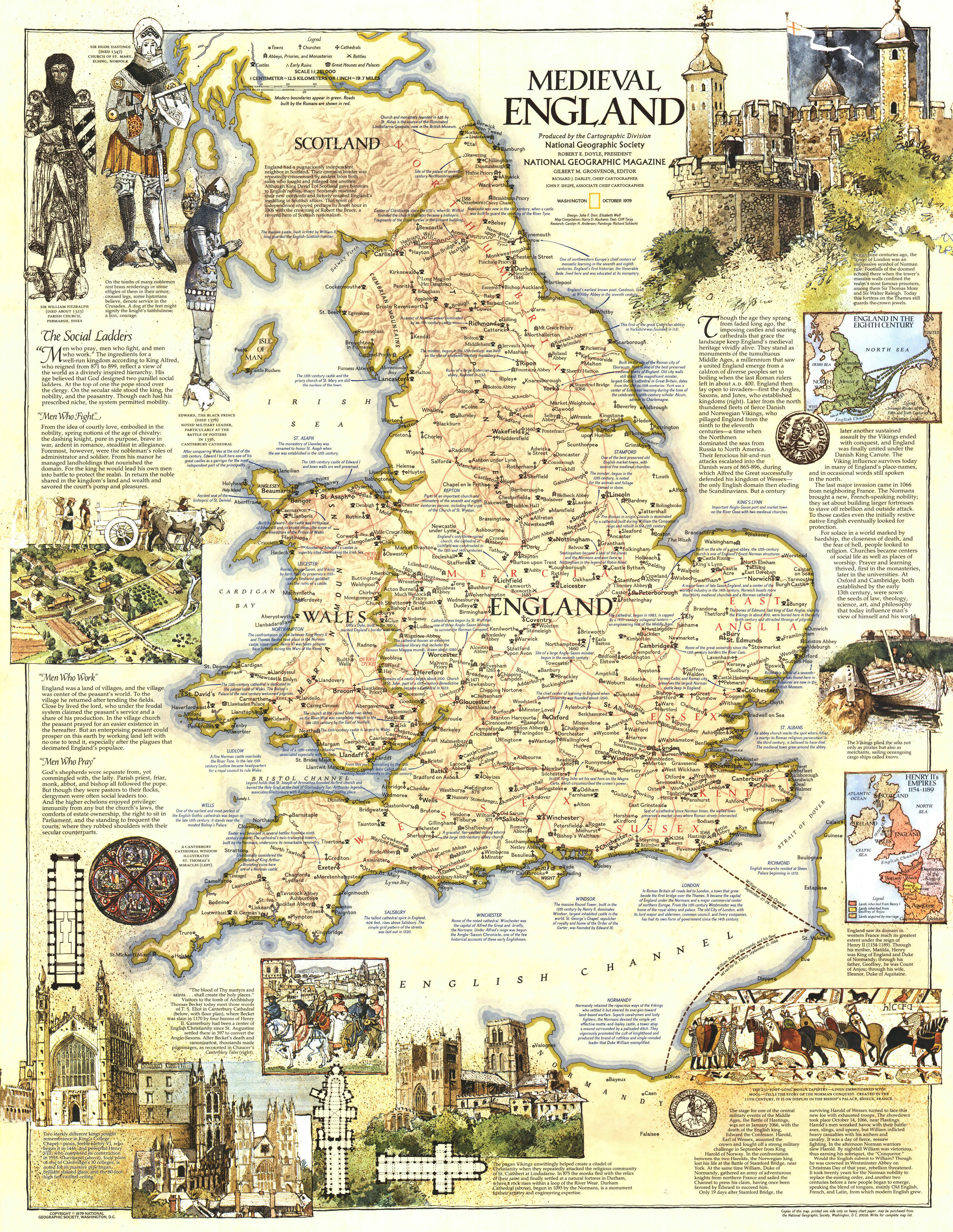
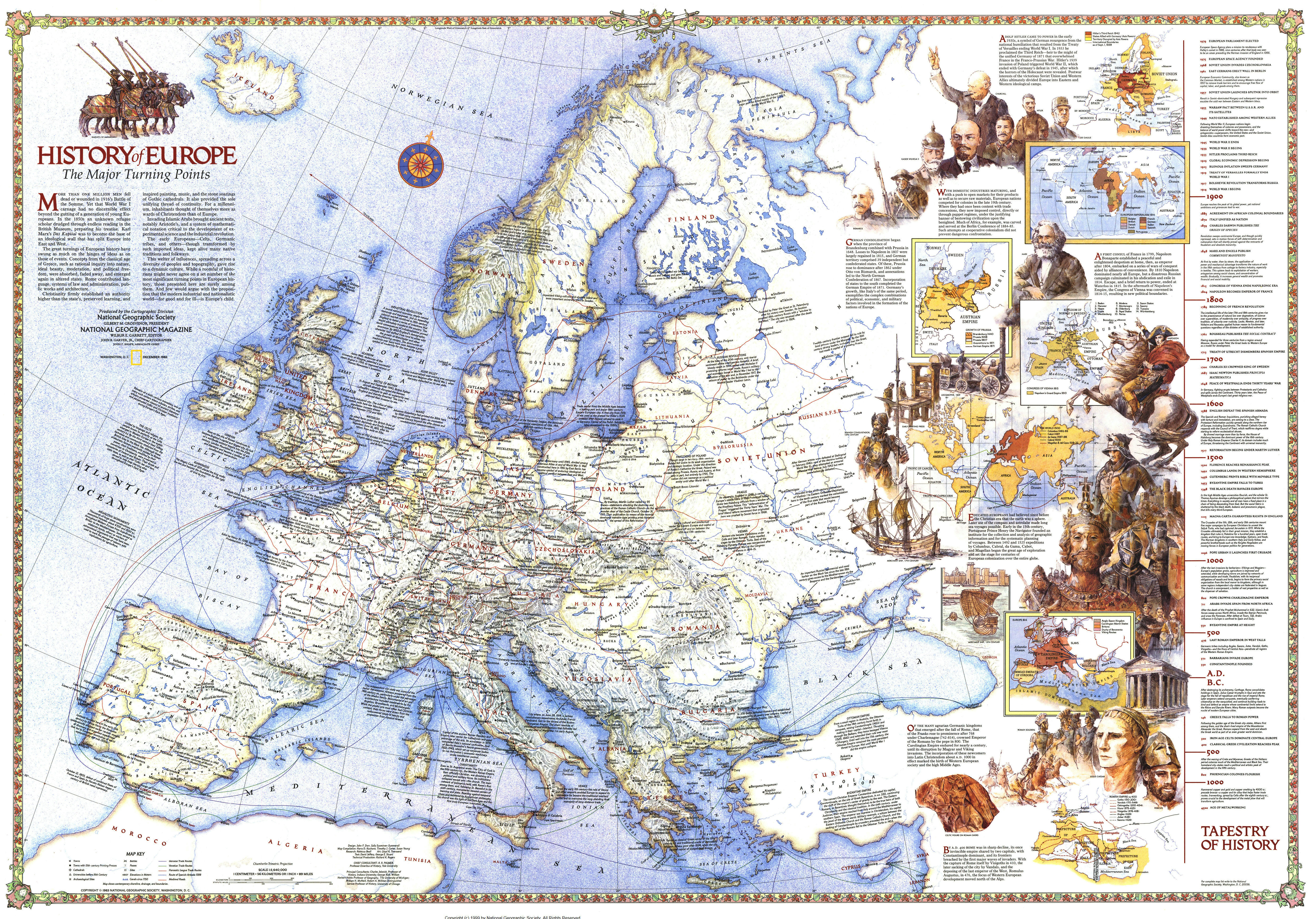
1-3. European History (NG England - Medieval (1979); NG Europe - Celtic (1977); NG Europe - History The Major Turning Points (1983));
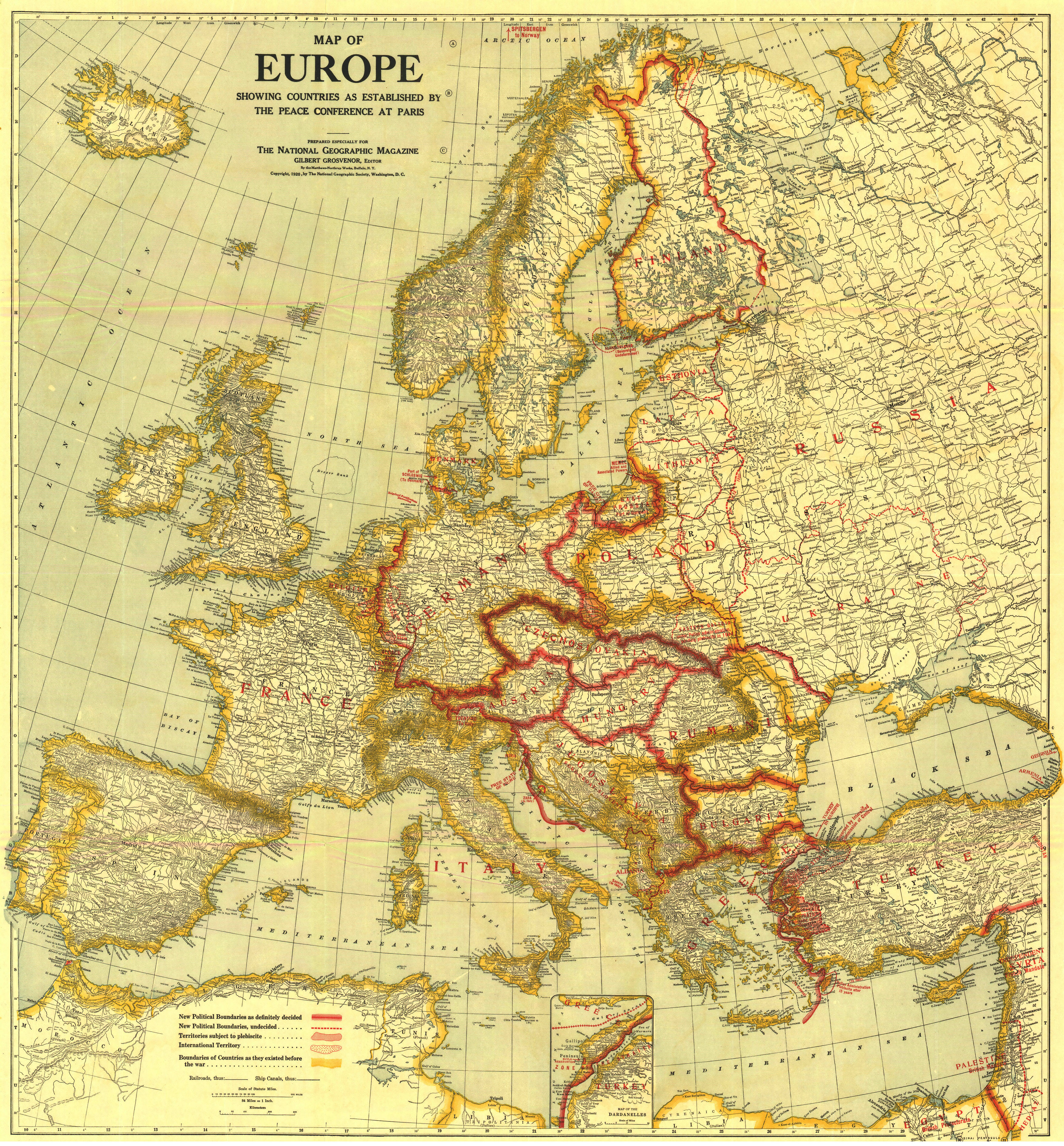
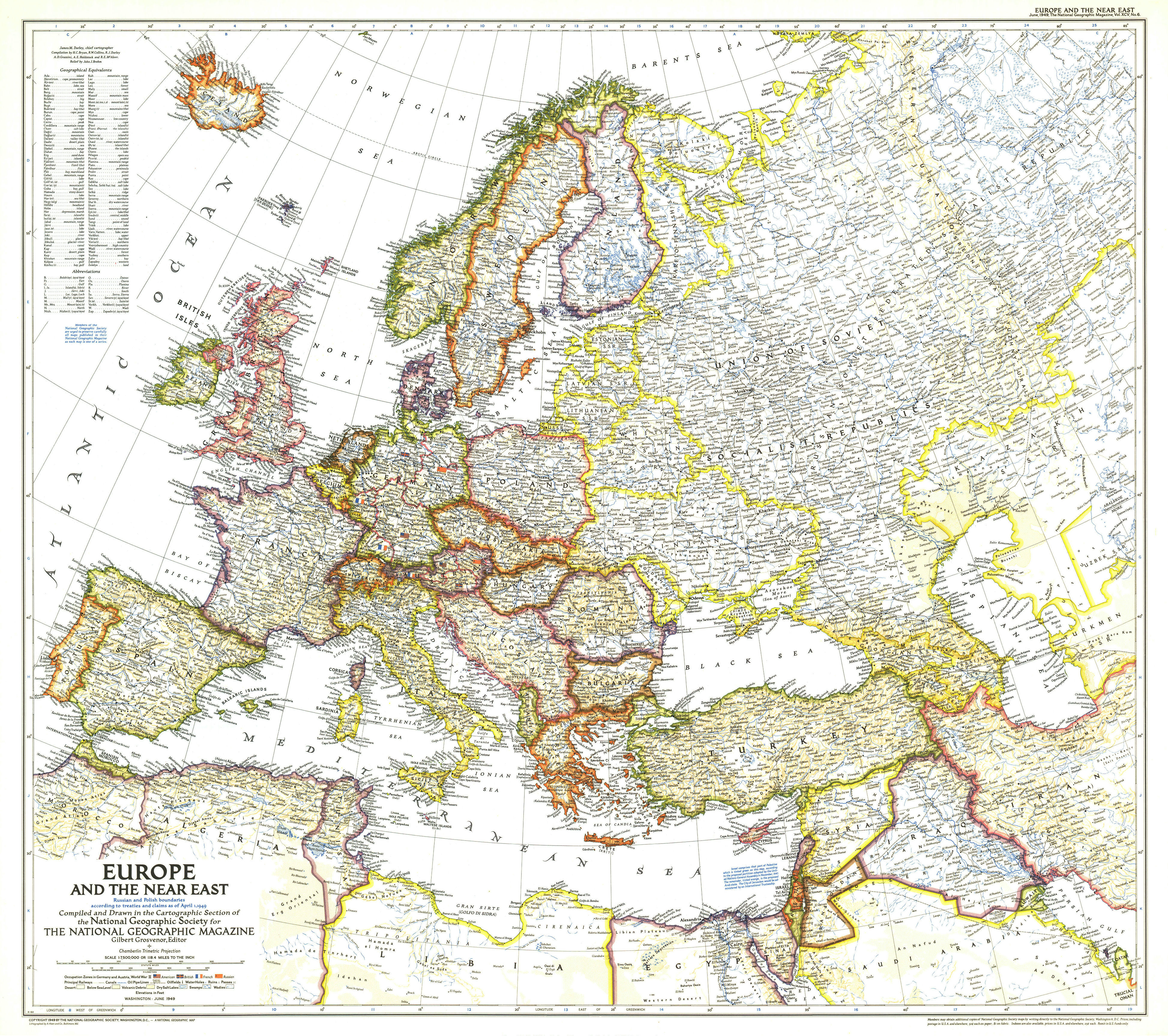
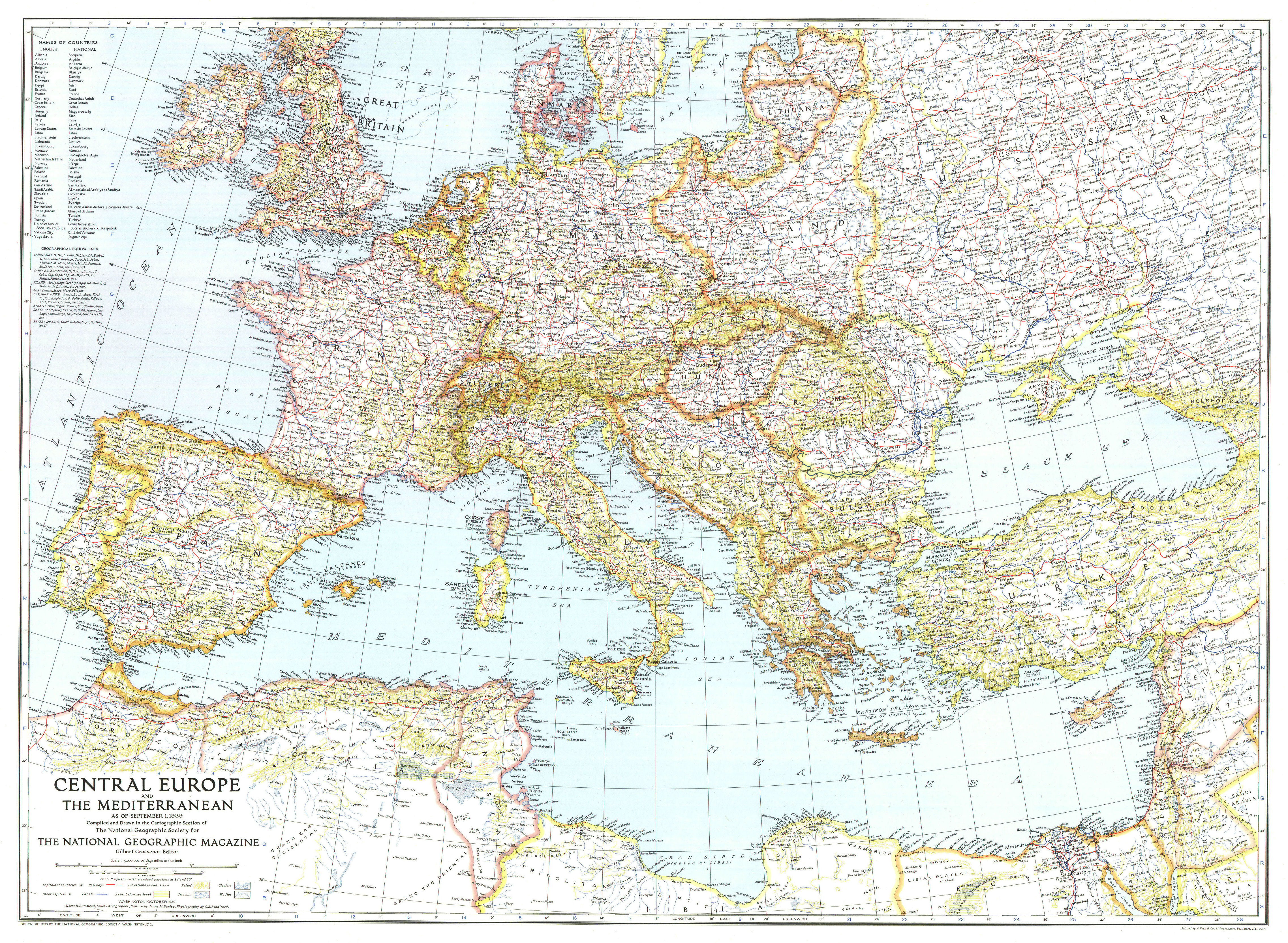
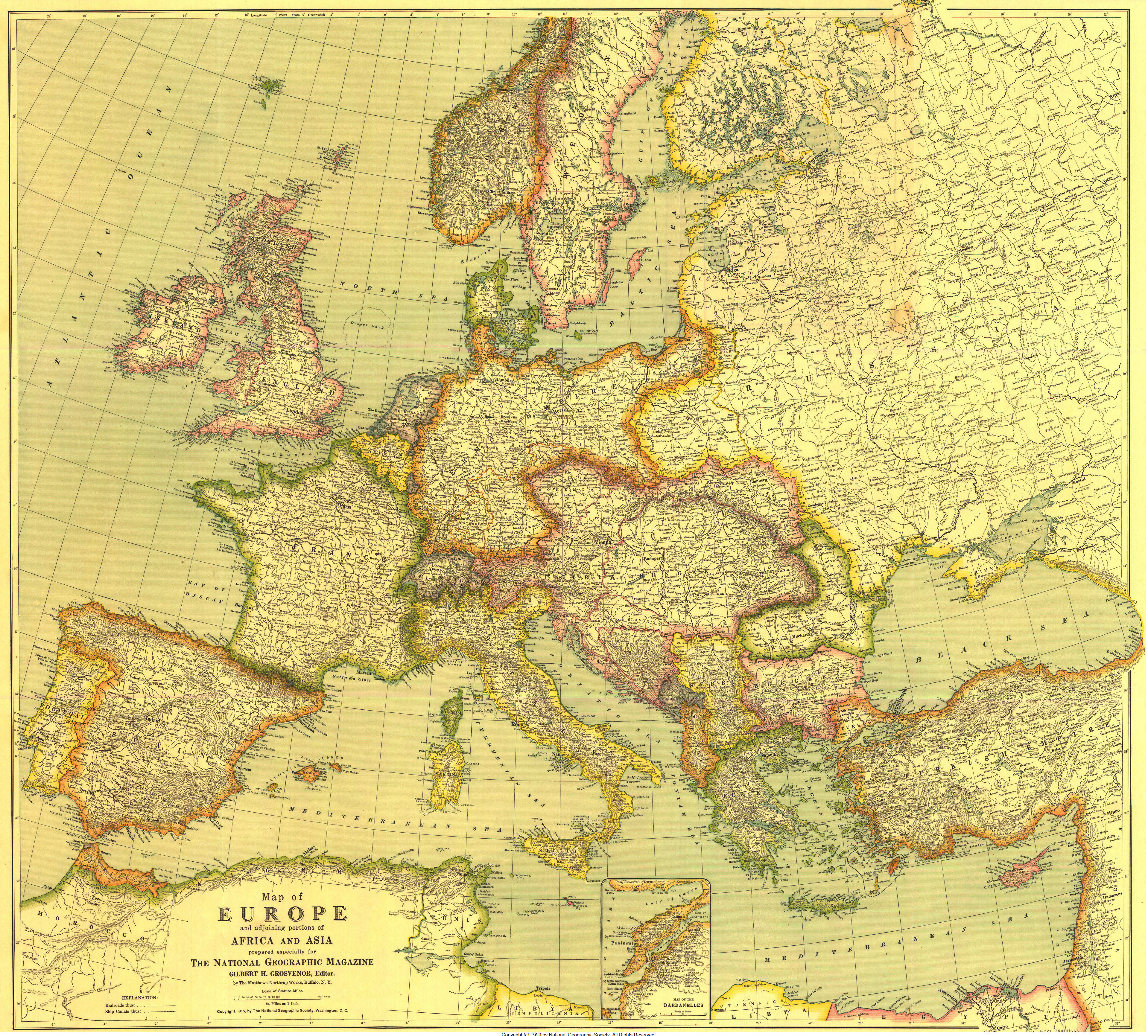
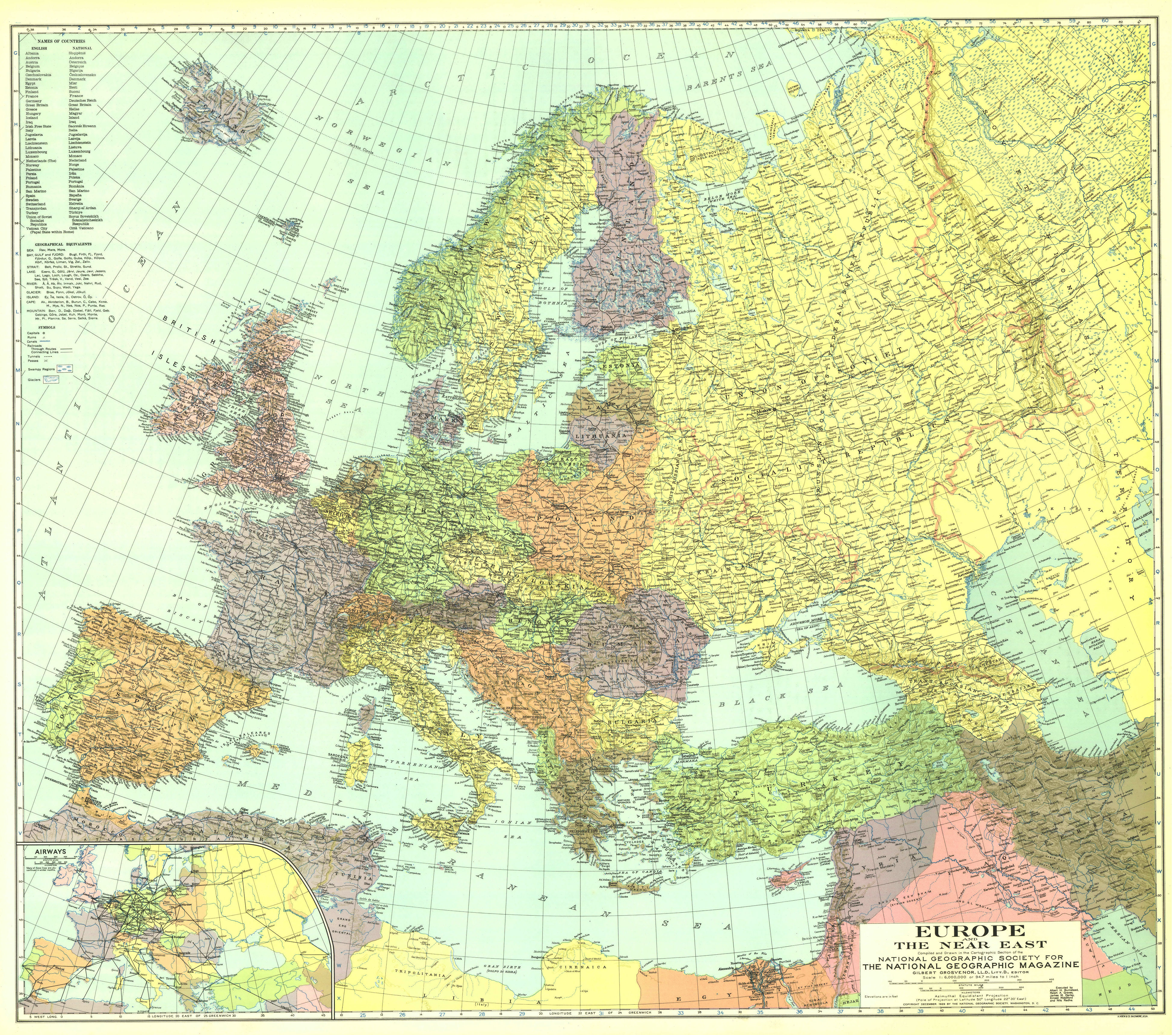
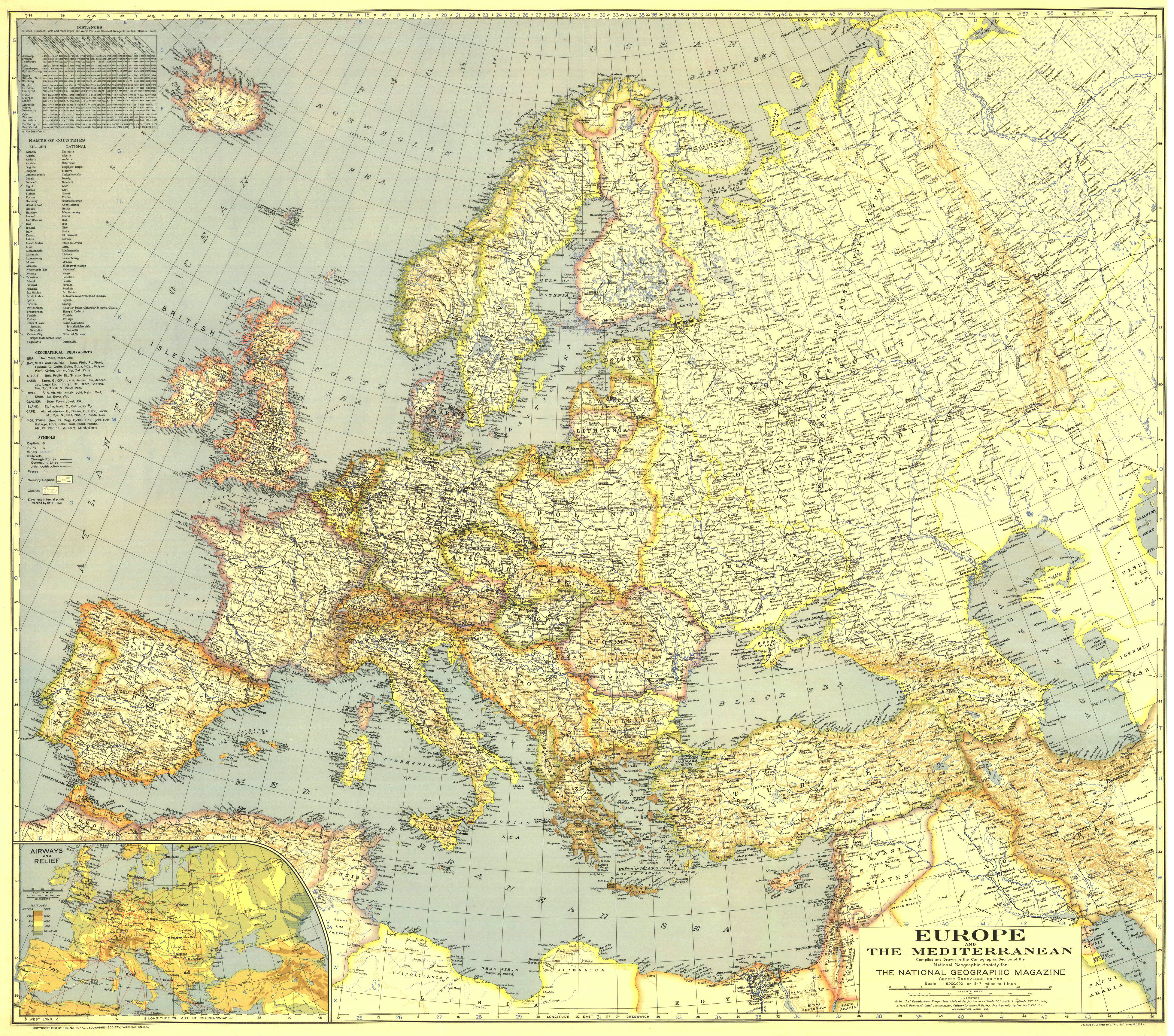
4-13. Territorial changes in Europe (first half of the twentieth century) (NG Europe and Africa and Asia (1915); NG Europe and the Near East (1929); NG Europe and the Mediterranean (1938); NG Europe and the Near East (1940 ); NG Europe and the Near East (1943); NG Europe and the Near East (1949);
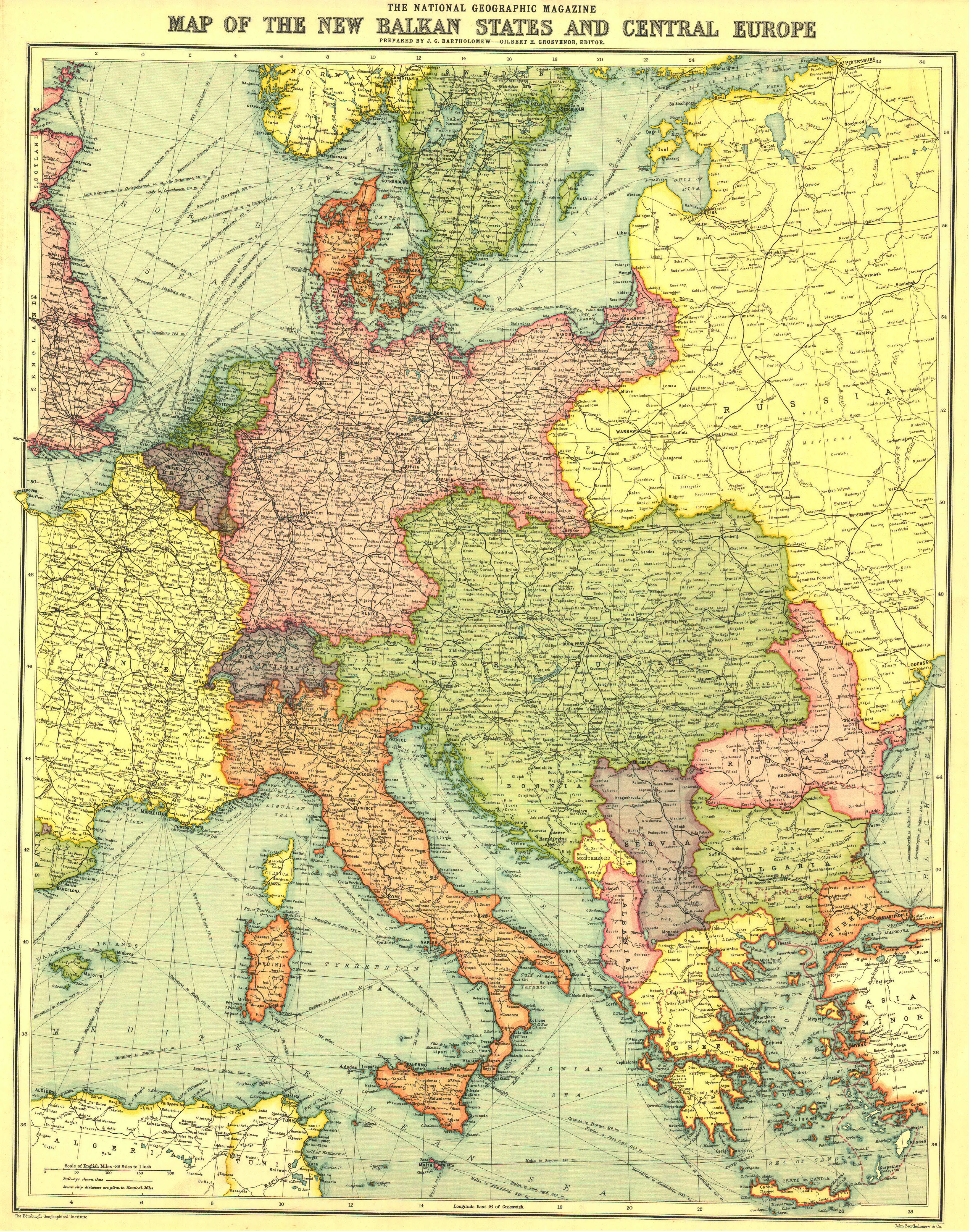
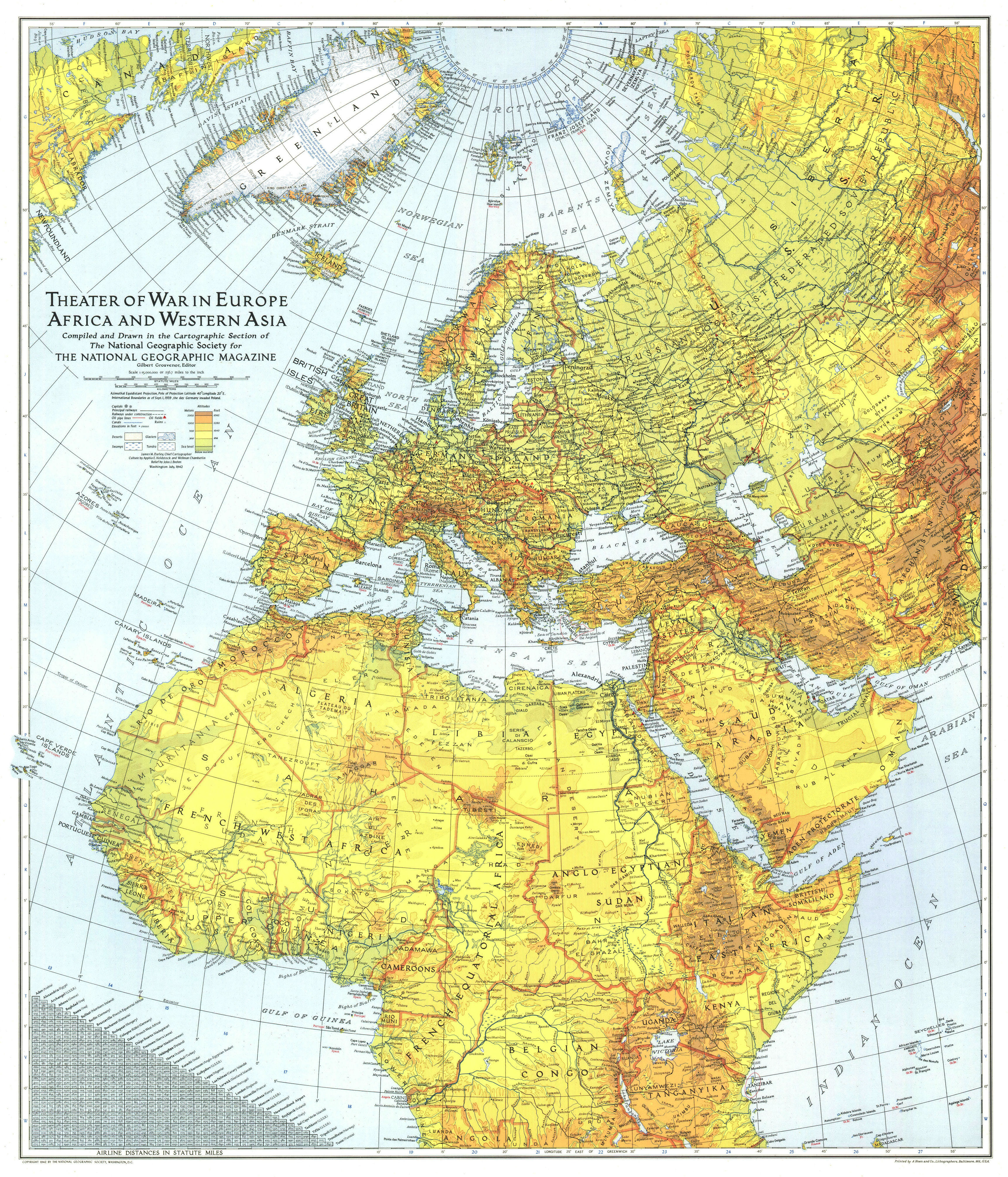
NG Europe, Africa, and Western Asia - Theater of War (1942);NG Europe, Central & Mediterranean Sept-1st (1939); NG Europe, Central & the Balkan States (1915); NG Europe, Peace Conference at Paris (1920));
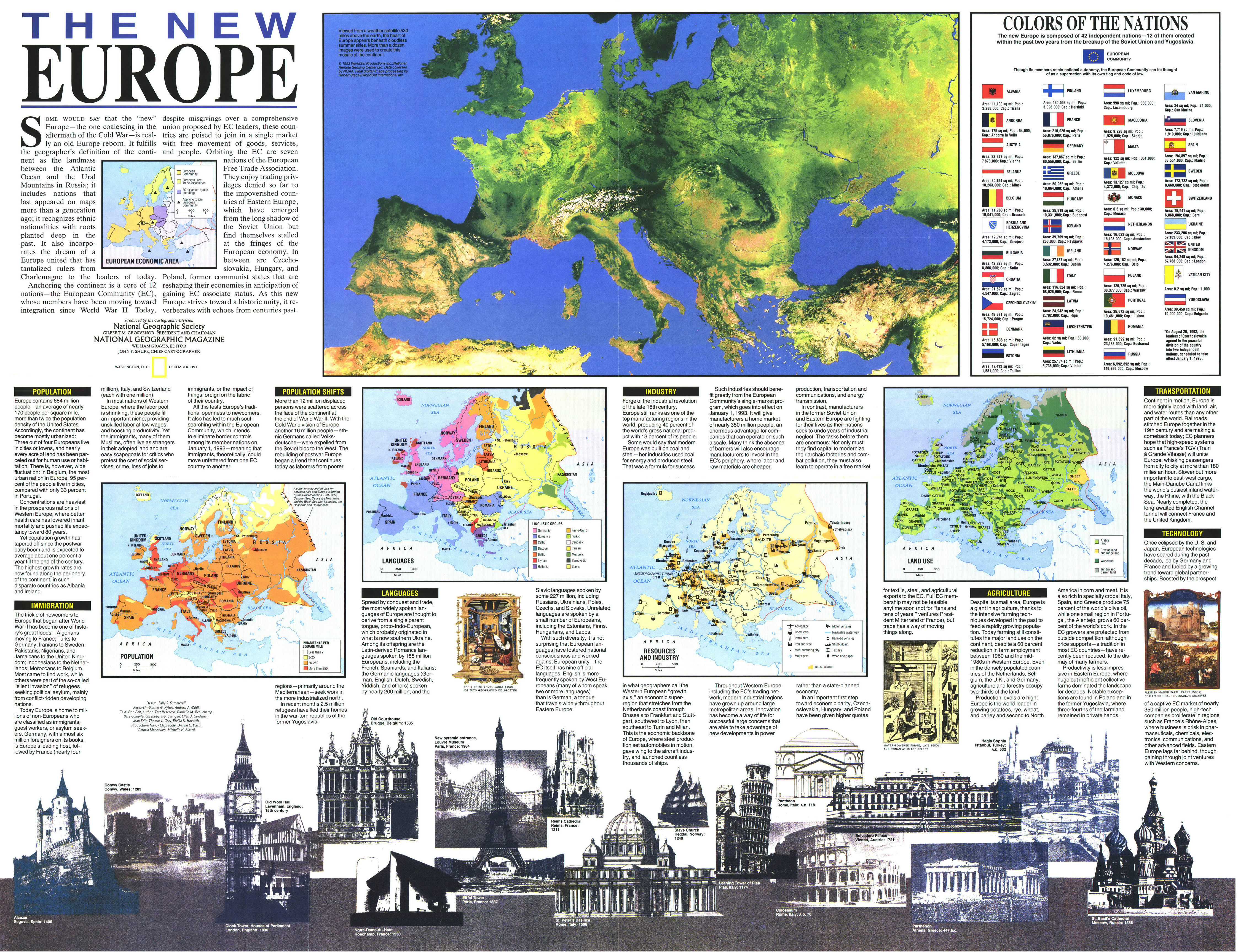
14. New Europe (NG Europe, The New (1992));
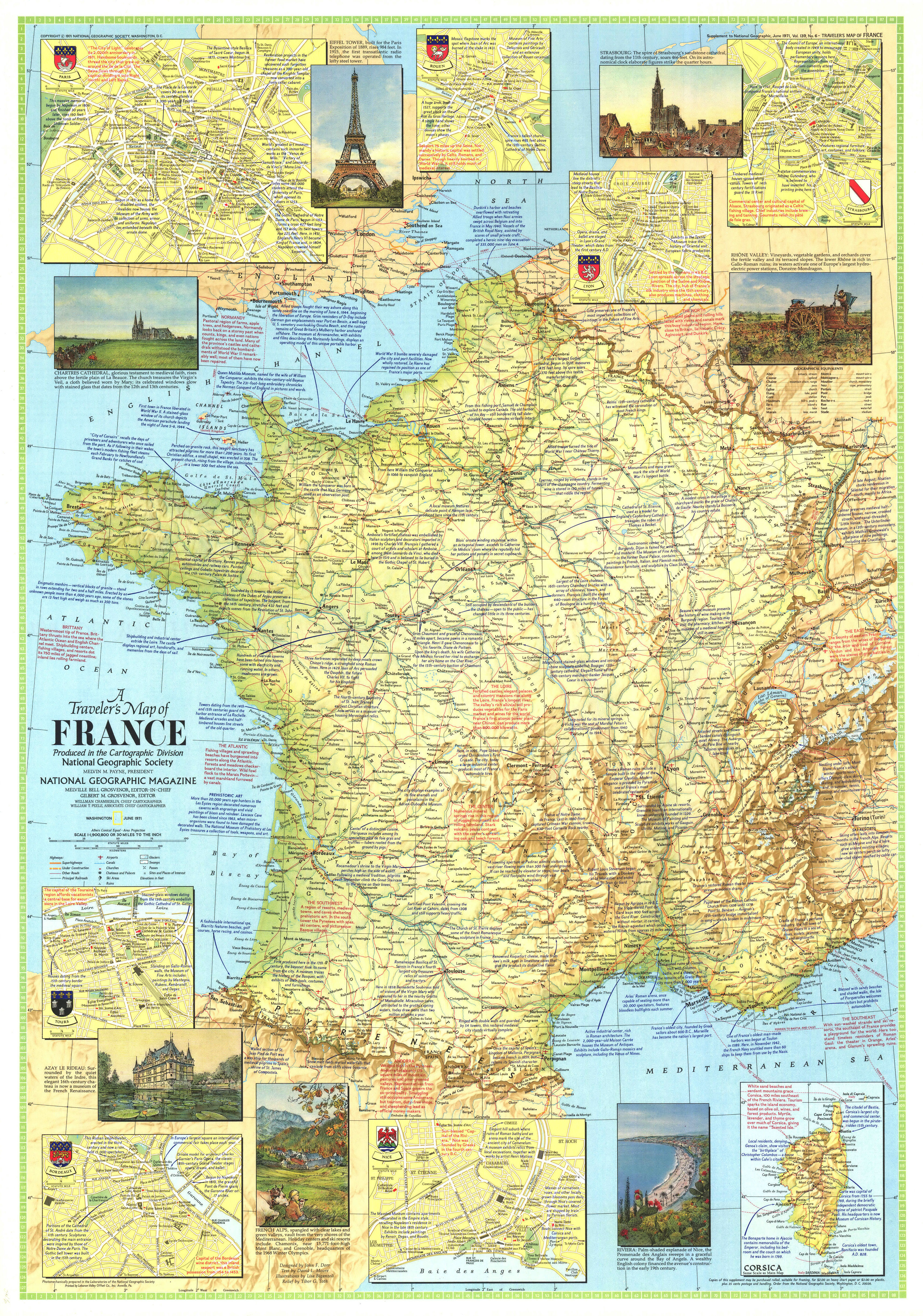
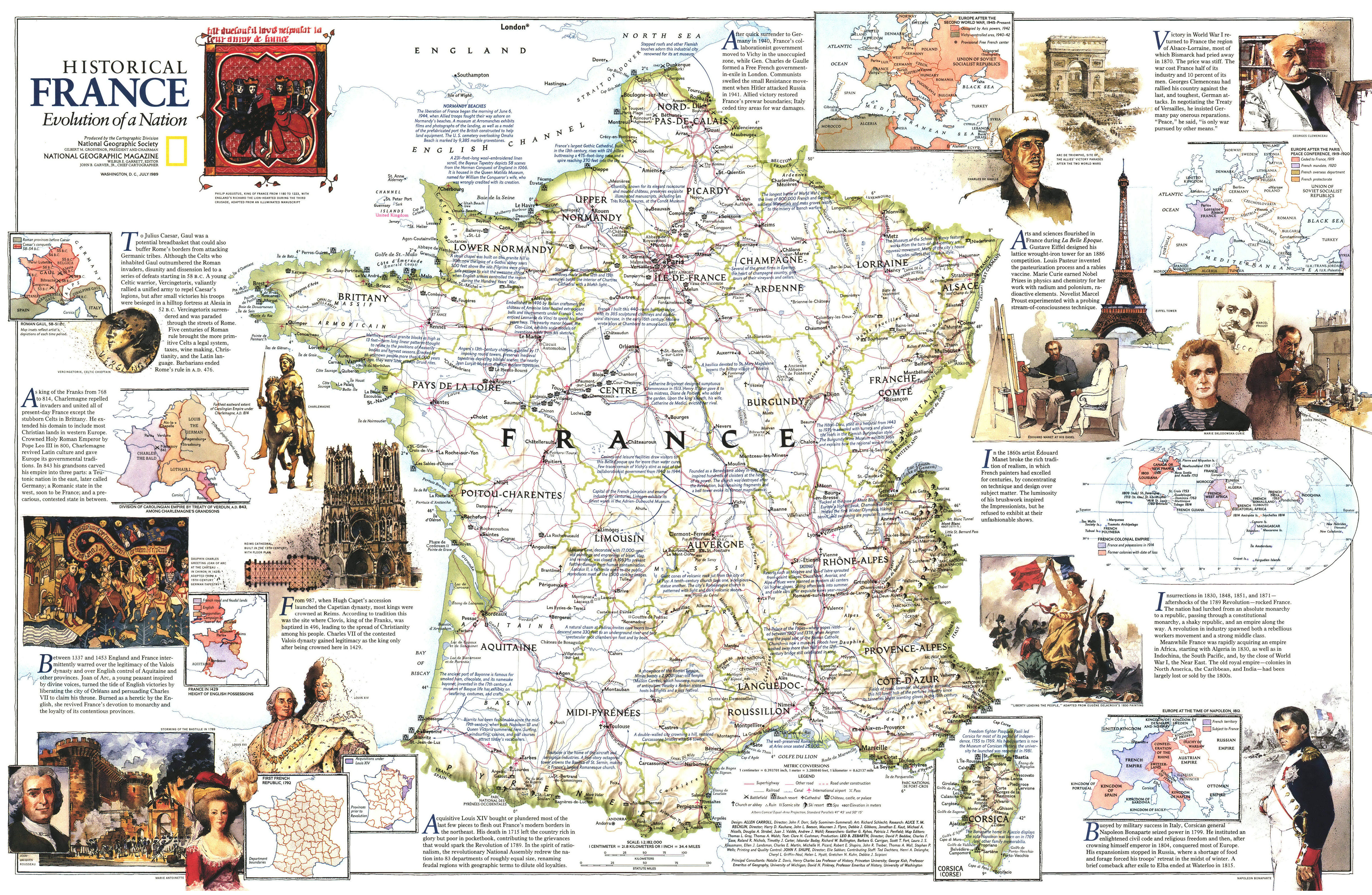
15-17. History of France (NG France - A Traveler's Map 1 (1971); NG France - A Traveler's Map 2 (1971); NG France- - Historical Evolution of a Nation (1989));
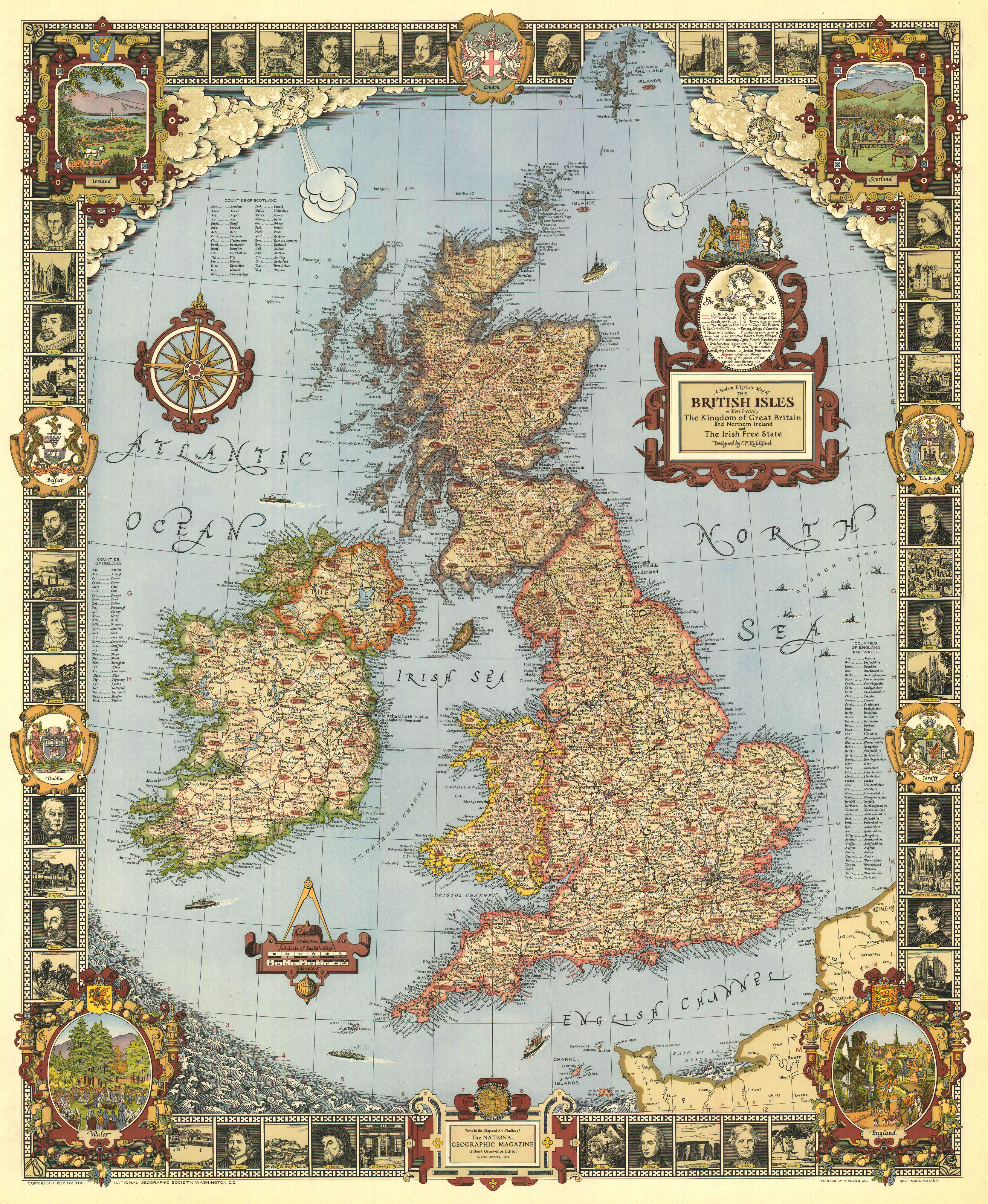
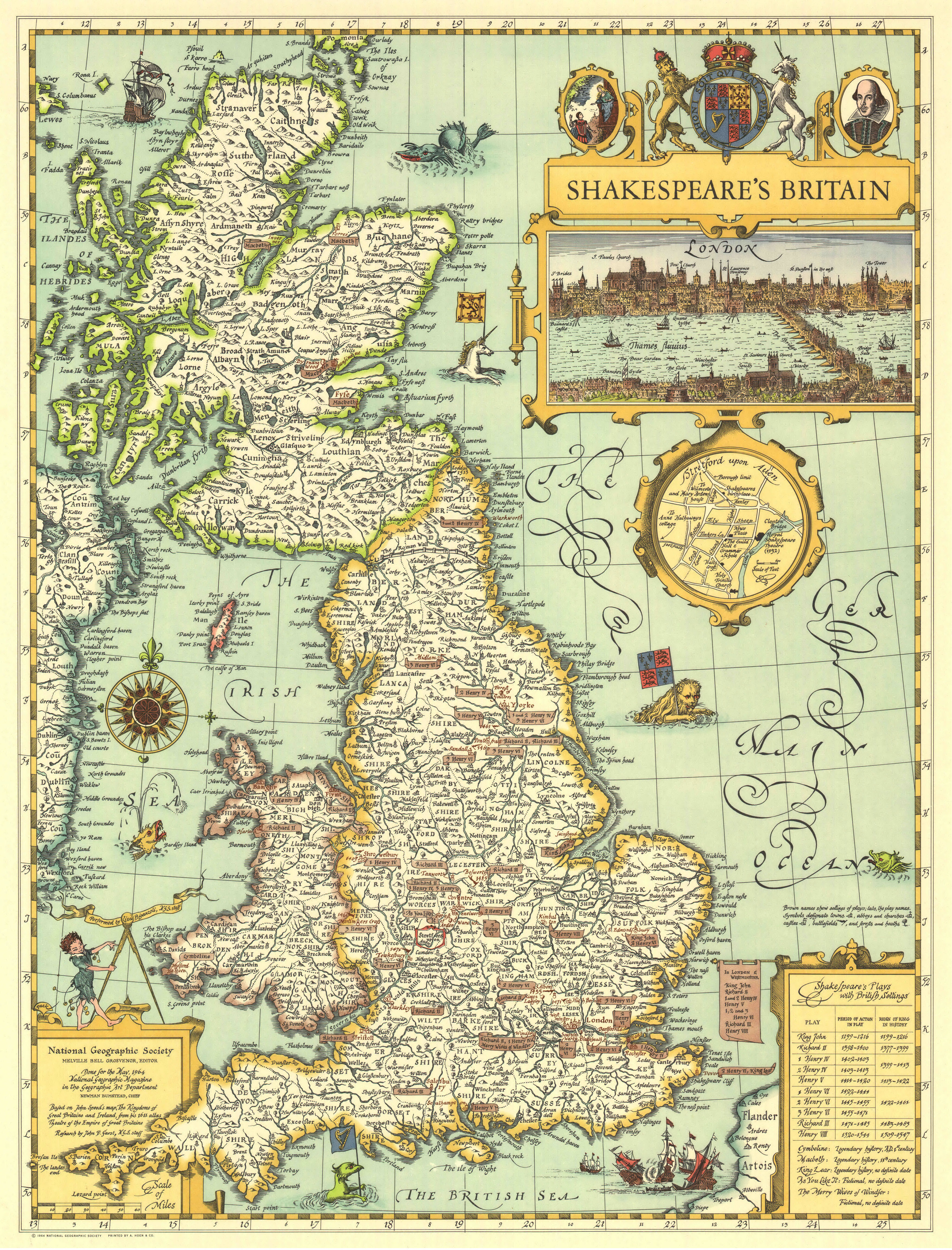
18-19. History of England (NG Great Britain - A Modern Pilgrim's Map (1937); NG Great Britain - Shakespeare's (1964)).
Title: Collection of maps from National Geographic
Author: National Geographic
Year: 1905-1995
Pages: 19 cards
English language
Format: Jpeg
Quality: from 1588x4961 to 4857x3426
Size: 97.4 MB


Download
Archive size 103.51 Mb, downloaded 531 times