Satellite images that show how much we've changed the planet
Artist Benjamin Grant focuses on aerial photographs of our planet. However, he doesn't depict picturesque wildlife.
The artist explores how humans have changed the face of the Earth over so many years of existence. For this, Grant selects satellite images from DigitalGlobe, which vividly illustrate the results of human skill. 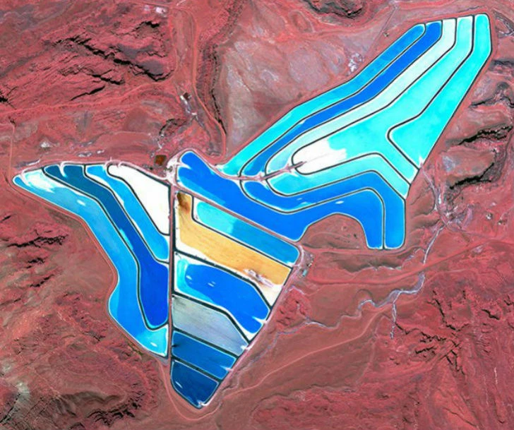
The beauty of the photographs undoubtedly attracts attention and invites us to take a step back to finally see how rapidly our world is changing. 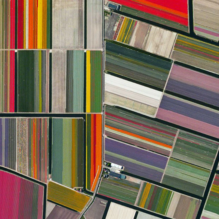
Tulip fields, Lisse, Netherlands. 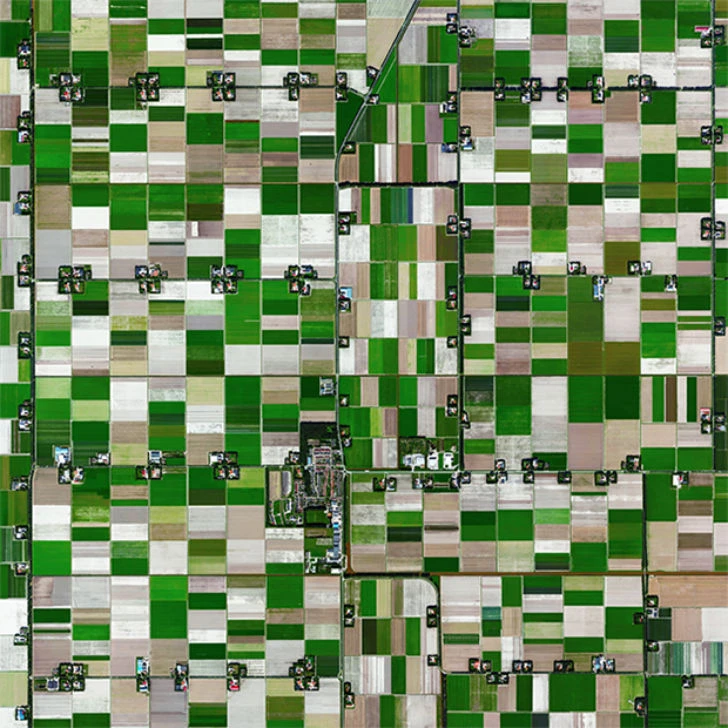
Как садят рис
Смотреть видеоEspel. Province of Flevoland, Netherlands. Population: 774.
[thumb]https://cp22.nevsepic.com.ua/post/64/1027_files/Valpara%25C3%25ADso-Chile-is-built-upon-dozens-of-steep-hillside.webp[/thumb]
Valparaiso, a city and seaport in Chile.
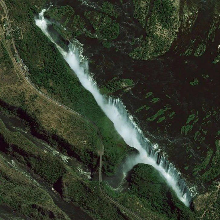
Victoria Falls on the Zambezi River in South Africa.

The Cléson-Dixence Dam, Switzerland, is a hydroelectric complex in the Rhône River basin, comprising several reservoirs with dams, pumping stations, and diversion hydroelectric power plants.
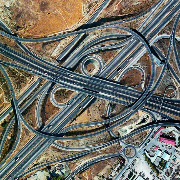
Highway interchange, Madrid, Spain.
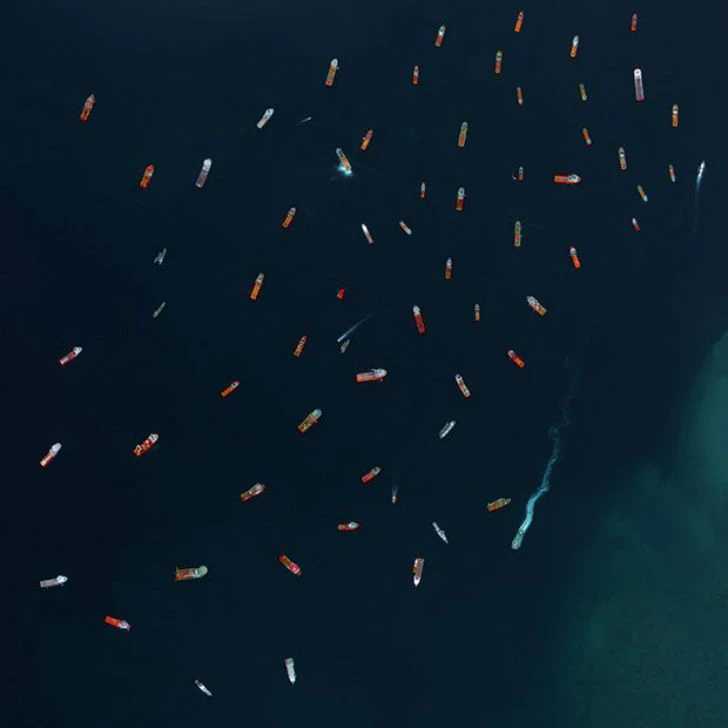
Oil field service ships, Labuan, Malaysia.
The volcanic island of Nishinoshima is located 940 kilometers south of Tokyo.
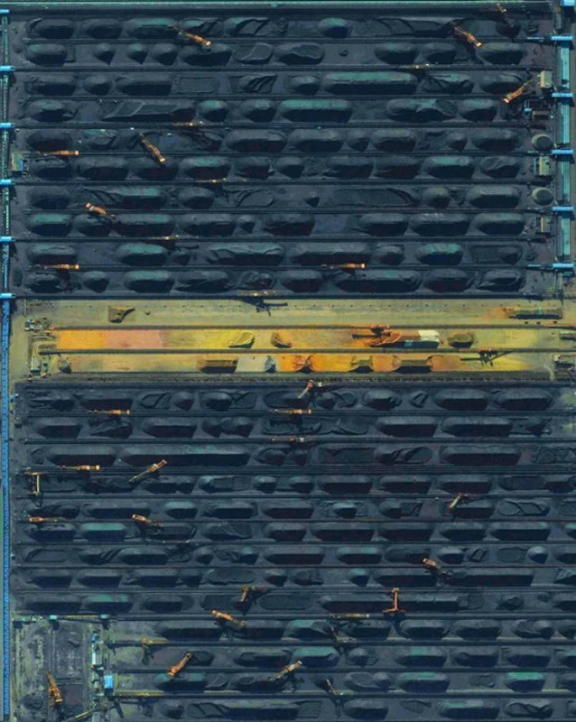
Data has been released showing that China is burning 17% more coal than last year.
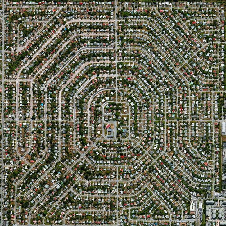
Melrose Park, Florida, USA.
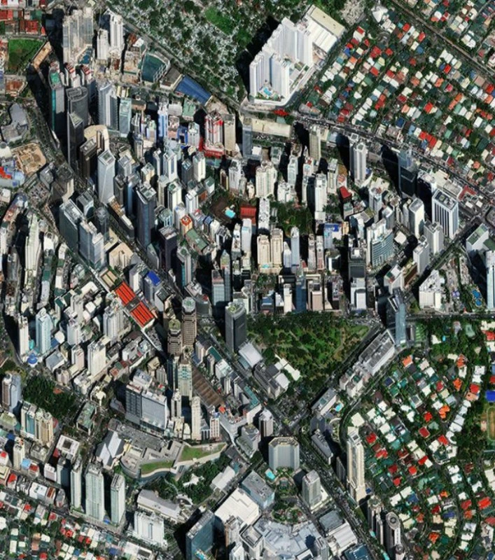
Makati City, Philippines.
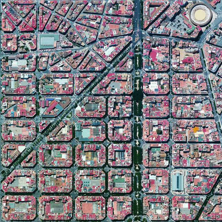
The Eixample, or New Town, is the most populated district of Barcelona, Spain.
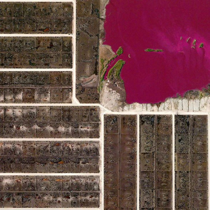
Cattle feedlot, Texas, USA.
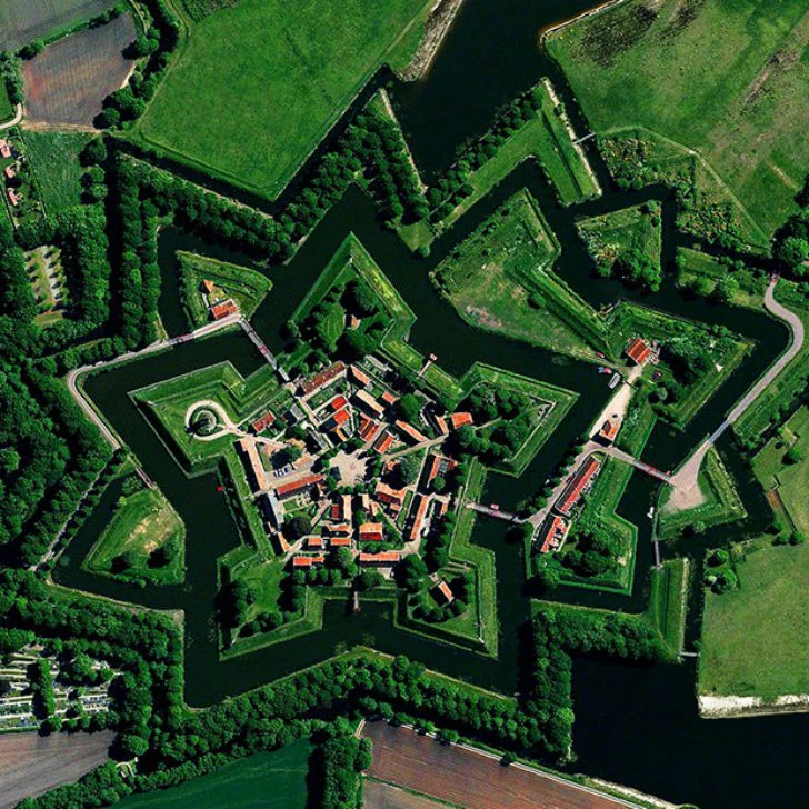
Bourtange Fort was built in 1593 in the shape of a star in the village of Bourtange, Groningen Province, Netherlands.
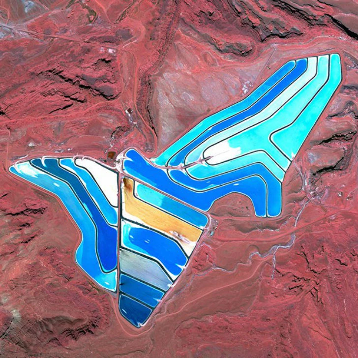
Blue evaporation ponds at a potash mining site in Moab, USA.

Farmland surrounds the Austrian village.

Download
Archive size 2.6 Mb, downloaded 42 times